We left our odd little campsite early with only a shake for breakfast. The rest of the three and a half miles to the Potlatch Dam was pretty straight forward.
The landing at the dam was really nice with a little recreation usage card for us to fill out our names, group size ect. The other side of it was certainly less than nice. We contributes it to the low water, but we ended up havering to carry the canoe over a pier of large, jagged rocks.
After the dam, it was a quick mile or so to get to our the Kiwanis Park. This park would serve as our landing to resupply in Brainerd. We didn't find water on site, and had to walk to miles to get grocery's and Lily chow. The walk back was a challenge, but the 17lbs. bag we normally get has 20% More, Absolutly FREE! Good for value, bad for walking.
We got back to the canoe and no one had stolen our stuff; we were a little nervous. The next ten miles were pleasant as we made our way to Crow Wing State Park. There we filled up our water and discovered that they had showers! We took the opportunity for hot water and charged the phones a bit.
The watercraft campsite was another mile down the river, so we left with only a half hour of daylight. The way the park was layed out, the watercraft campsite was right next to a group campsite. When we got ther, a tent was already set up. Maggie talked to them and 60 more people were coming. We ended up camping across the river on another spot that normally floods. Dry cracked soil with plenty of wood was the makings of a pleasant night.
Friday, September 28, 2012
Wednesday, September 26, 2012
Day 14: W 9/26- Lunch Excitement
We got up a little bit late, but started on the river at 8:00. While we were going to shoot for a campsite 38 miles away, we had decided last night to aim at a little piece of state land 31 miles out.
It was a fairly ineventful morning, saw a few cows grazing by the river. The problems started after brunch. We stopped on this little delta sand/mud island created, by the Aitkin County Flood Diversion Channel.
It was a nice break. A mink came up to check us out, peeking from behind rocks. Lily didn't notice for a long time, but nearly exploded when she finally did. When the mink came up the grass for a better look. Lily jumped the mud and water and started chasing the little guy in a very clumsy Scooby Doo style. When I started to go after her, I sank up to my knees in thick clay.
After the lunchtime excitement and washing my pants that were covered on clay, we were back to paddling. The water level seemed to go down again as large rock beds and boulders started to emerge. We confirmed that this theory when we reached the Highway 6 Bridge. It had a level gauge, low is under 3.5'and below 2.5' was suppose to mark poor boating conditions. The water was just below zero, poor boating would certainly be ahead.
We made it through a little frustrated and slow, but we finally reached Pine Rivers outlet. This marked a small section of state land that we would camp on that night.
We camped right on the beach next to our canoe. The soil was a good mix of sand and pea gravel, which was a nice change from sticky, clay mud. We We had an hour of sunlight left and used it to journal, blog, and read a little Huck Fin before bed.
Day 13: T 9/25- Aitkin post office
We had to make 23 miles to Aitkin and get into town before the post office closed, so we were up early and out by 8 or so. The paddling was easy and it was a nice, warm-ish day.
We paddled pretty much continuously to get there on time and got in around 2:30. We stopped at a small state campground and tied the canoe off a muddy, steep bank. It was about a mile walk into town and the park seemed safe enough, do we both went and brought dog along.
We found the post office no problem and picked up the box mom and dad had sent. It had a doggie blanket for Lily, some extra , warm pants, a pocket saw, tarp and some dried cherries. Thanks!!!
The gal at the counter said there wasn't much for grocery stores within walking distance, just a few gas stations that might have the basics. We tried the first two, with no luck and on the way to the third found a pharmacy. They had most of what we needed for cheap, so it was a good stop. On the way back we hit up the local bakery and picked up some day-old doughnuts as a treat.
We had thought about going a bit farther since it was such a short day, but after the trip to town we were about ready to call it quits. There wasn't any body else at the park, so we grabbed a spot on the sly and pretended we had registered.
There wasn't much for firewood and we didn't want to attract attention anyway, so we busted out the camp stove to make some spaghetti for dinner. We called home, read a bit of Huck Finn and called it a night.
Sometime during the day we also passed this almost, but not quite, finished beaver chew.
Day 12: M 9/24- Palisade, MN
The morning was pleasant. The weather was nice and scenery lovely. We made quick miles for the 15-16 to get to Palisade.
We pulled up to the access between two bridges (pics) and found a little Aitkin County Park. It had half a dozen RV spots and a pavilion that we immediately took advantage of to start charging the phones. While we waited, I took a leisurely stroll into the cute little town. The roads leading to main street were one lane in which I didn't see any cars, but numerous bikes and a 4-wheeler cruising around. On main street, I caught them on sidewalk washing day. Everybody was very friendly and helpful. The gas station doubled as a grocery store in which I was able to restock a lot of our supplies for a reasonable price.
Once I returned to Maggie and Lily and waited a little longer for the phones, it was back to the river for another eight miles to get to the Willow River Campsite.
A family was already there, so we decided to camp across Willow River, right on a point that looked like it normally flooded. The ground was smooth and the firewood ample. We were going to go visit our neighbors for a bit; but by the time we got set up, most of their party was in the process of leaving.
All in all, it was a pleasant day and a pleasant evening.
Day 11: Sn 9/23- Bath time
As we were about to fall asleep Saturday night we finally thought to check the maps to see where we were heading the next day. Unfortunately our options were too short, 21 miles, or too long, 36 miles. As we were half asleep already, 21 miles seemed like a pleasant break and we left it at that. The next morning the alarm went off at 7, like usual, but we kept right on sleeping. By the time we roused ourselves it was close to 8 and our chances of doing 36 miles were slim to none anyway.
So, we got underway leisurely and left close to 10, aiming for Scott's Rapids campsite. We realized too late that this set us up for a string of shorter days due to the placement of dnr campsites along this stretch of the river. Oh well, we figured we could make up for those few 20-25 mile days down a ways.
The day didn't take long at all and the river presented no real challenges. We were paddling through mostly farmland and spotted a few cows down by the water, but not a whole lot more. We did note that we had been seeing an absurd number of bald eagles each day.
Since we had such a short, and warm, day, we decided it was time for another bath once we got to camp. The site was thankfully mud free, along a rocky stretch. Aaron made a fire as soon as we got there, we changed into our suits and pretty quickly decided it wasn't nearly as warm out as we had thought. The water was chilly, to say the least and we went as quick as possible to avoid brain freeze and other unpleasantness. I had big plans of washing some clothes, but the ten minutes it took to wash me was more than enough time in the water. We hightailed it back to shore to shiver by the fire.
Day 9: F 9/21- Nothin' much
According to the weather, this was supposed to be another chilly, rainy day. We were all thrilled, especially dog. Luckily, it wasn't too bad, though we did don our rain bibs just in case.
There was supposed to be a river level gauge under the co. Rd. 441 bridge, but we didn't see it. We just figured the river was low, as it had been for, well, all of it.
We had a short, rather uneventful day of 23 miles and stopped at the Swimming Bear campsite. We had managed to stay dry for most of the day and were happy to have made it before the wind and rain started up. The site's landing was about 30' upstream of the site itself and there was a steep path up and then over to get to the site. And the mud! The landing was a soupy concoction of what seemed to be mostly axle grease and bird poop that made unloading a dream.
Since we had ended quite early, around 5, we had big plans for journaling, blogging and hanging out, but shortly after we arrived the sprinkles got there too. We ended up cooking dinner under some trees and staying fairly well sheltered (dog hid in the tent cave, of course) but sought refuge pretty early. Since the site was on a ledge overlooking the water, it was pretty neat watching the wind play over the river. And every gust of wind brought down a sprinkle of yellow leaves that settled on the current.
As we were bedding down, it became obvious pretty quick that the tent wasn't exactly what you'd call water tight, which is exactly what a tent should be called, IMHO. But we did what we could to tighten it up and were thankful that the weather was supposed to clear soon.
Day 10: S 9/22- A sad day for ducks
We knew it was Saturday, when we awoke to the thunder of over a dozen shotguns in the distance. Like the guy scouting had told us earlier, duck season was starting and hundreds of guys would be out there. We were out of the state land and into private property, so we didn't run into any hunters.
The day was windy and a little wet, but we powered through the twenty-eight miles. The river serpentined back and forth; giving us the chance to rest an equal time with fighting headwinds.
Just before dark we landed at Ms. Keto campsite.
The day was windy and a little wet, but we powered through the twenty-eight miles. The river serpentined back and forth; giving us the chance to rest an equal time with fighting headwinds.
Just before dark we landed at Ms. Keto campsite.
Tuesday, September 25, 2012
Day 8: R 9/20- Dam!
We got going on the river after 9:00 but made good time through the rest of the wetland area. It was only a little more than a mile before the river went from being classified as "wild" to scenic.
Luckily the wind was mostly on our side today, coming from the NW. This became incredible important when we entered Blackwater Lake, a reservoir of the Pokegama Dam. The wind pretty much did our work for us, pushing us to the exit point.
From there it was a short trip to the City of Cohasset. We stopped briefly to fill up the air in the wheels of our canoe cart. Then back onto the river for a few more miles.
The Pokegama Dam had a nice portage route and we even found power at a pavilion to charge up the phones. We got back in the river and reloaded the canoe from a little fishing pier.
The river expanded over the next six miles into the reservoir created by the Blandin Paper Company Dam. This was our long 1120 yard portage.
First we couldn't see where the portage started. There was a bay to the right of where we could see a red barrier line. We decided to try and follow the side of that bank. When we crossed the bay, we luckily ended up right at the portage sight. While the map said that they had a phone and portage help available, no help was available here. Luckily we had filled the carts tires. The portage was located practically in two people's backyards, then went through two others before it got to the alley. From there we had to cross a busy street during rush hour with no stop light in sight, playing Frogger with a 18' canoe. When we finally made it to the other side and found the entry side of the portage,; we discovered that the ramp at the portage was under construction. With pipes and construction equipment everywhere, we made our way through the maze.
We launched and made our way to the Riverside Park, a half mile downriver. We stopped and I went to get supplies from a "Lucky 7 General Store". With a hitchhiked ride I found out that the "Lucky 7" was a little gas station that didn't have anything I wanted. He took me to a "Holiday" that I was able to get enough of the things I needed.
I hurried back to the canoe and Maggie and I busted out the next six miles in less than an hour and a half.. We stayed at Sucher's Campsite that night. We turned in early after the 26 mile day.
Monday, September 24, 2012
Day 7: W 9/19- Rain!
Day 7 took us through more wetlands and a very twisty section of the river. We were thrilled to be out of the lakes and the very shallow part of the river and expected to make good time. We aimed for a campsite 30 miles down river and chose one 27 mi down as backup.
The weather showed a chilly day with possible showers in the afternoon. Luckily the wind was out of the NW and we were headed primarily SE. So, the wind was mostly helpful, though we did catch it in the teeth a couple of times going around bends.
We stopped for lunch under a highway bridge just as the sprinkles were starting. We put on our rain overalls and jackets just in case and put lily's life jacket on her to keep her warm. We tried using our spare rain slicker to make a shelter for her in the canoe, but ended up just tying the arms around her neck to make a cape. She seems to tolerate that pretty well and when she curls up in the bottom of the canoe she stays out if the wind an pretty dry. A doggie blanket is also on the way which should help keep her warm on days like this.
Along the way we saw several boats loaded with guys in camo. We asked one if they'd had any luck, but they we just out scouting. When we landed for the night there was a young guy pulling his boat out who said opening day wasn't until Saturday. He said the boats would be 20 deep waiting to put in by 3 am and the whole area we had just paddled through would be packed with bird hunters.
By the time we were approaching the 27 mi mark, we were cold, wet and tired and decided to call it good. We made camp, had some pasta and beans and we in be early. We stayed at Schoolcraft State Park, which was a pretty little campground with a bunch of pines and an old fashioned hand pump for water.
Friday, September 21, 2012
Day 6: T 9/18- Fish Fry!!!
We got up early the next morning, made a little fire to take the chill off and make coffee. We headed up the rest of the east shore, which took a couple of hours. Finally we reached the north end of the lake which started us along the longest stretch of the lake. We ate our lunch snack, hard boiled eggs and honey sandwiches, on a little peninsula formed between Lake Winnibigoshish and Cutfoot Sioux Lake.
After lunch we started heading into the big west bay of Lake Winnie. At this point our arms were tired from battling the wind, and when we came upon a shallow area in the lake; we decided to get out and pull/push the canoe for a quarter mile. This also gave Maggie and I the chance to bathe, as we were beginning to smell less than fresh.
Coming back South in the bay was difficult because the winds had shifted against us, but we pushed through.
The portage was right on the side of the dam which made Maggie nervous. We first landed a hundred feet shy and checked to see if that was really the correct spot before getting so close to dam. The portage path ran straight up a steep incline which took both of us to get the canoe up. Lily didn't help much. While I finished pushing the canoe and the gear over, Maggie ran ahead to start charging the phones at an outlet under a pavilion on the other side.
While we were waiting for the phones to charge a guy from a charter fishing group came over to ask us how far we were planing on going. We started talking to him (Dick) and his son (Alex) about our trip and they invited us to join them for their fish fry dinner. It was really nice being able to chat with them, and the fish fry dinner was an amazing treat after a long day on Lake Winnie. Charlie, the fishing captain, had some amazing culinary skills as well. He first seasoned some potatoes and onions in a big fry pan which we all started snacking on while he perfectly fried up over a dozen fillets. We all ate till we were content and at the end they put all the leftover fried potatoes into a bag for us to take with us. The meal and the company made for a very memorable reward for our efforts.
We didn't want to camp there, so a little behind schedule we headed back out. The river opened up into Little Winnibigoshish in about a mile. A much smaller lake that we paddled through just the south-east end. Another four miles through a pleasant twisting river put us at our camp for the night. Crazy James Point was a pretty little campsite set on a high bank overlooking a bend in the river. Lily had a blast chasing the numerous frogs, while we enjoyed our evening without without having to make dinner. A delicious snack of leftover potatoes by the campfire was enjoyed before turning in for the night.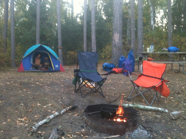
Day 5: M 9/17- More lakes!
Once again, no pictures for this one, but it consisted mostly of getting across lakes. The waves had gone down since the night before, so getting off the island was okay, but still hard work. We decided to head back the way we had come in, to the NW, which meant some backtracking, but was the safer route. After we got back to the N shore we were pretty well sheltered from the wind and made it to the mouth of the river 4 hrs after breaking camp.
We had a short portage around a dam at the end of the lake. We stopped for breakfast and to refill our water before heading out. The next several miles were through pretty wetlands and we made good time. We ran into another pair of kayakers, Vicki and Peg, who had been paddling the river in sections for a couple seasons.
We came to Lake Winnie late afternoon and decided to try and get a few miles up the east shore before dark. This is a huge lake, MN's 3rd largest, and was 15 river miles. We paddled pretty close to shore the whole time and figured we did 20 on the lake. But, for Monday night, we were happy to knock out 4 or 5 and made camp in the woods.
Apparently the spot we chose was popular with all sorts of critters too. There were raccoon and deer tracks along our landing spot and signs that deer had bedded down there recently. We heard raccoons nosing about throughout the night and at one point heard them banging at the canoe. It stopped once we yelled, but the next morning there were two neat little 'coon paw prints in the frost on Aaron's seat.
Wednesday, September 19, 2012
Day 4: Sn 9/16- High winds on Cass Lake
We had a slow start the next day after our race to Stump Lake, but got going around 10. We ran into kayakers ken and Dave who were headed for the Twin Cities as we were leaving and ended up crossing paths with them a couple more times throughout the day.
Made it out of the lake and to the Otter Power dam pretty quick and did our first portage. The wheels worked great, thanks Jim and Sharon, though they need some air. After that we hit some shallow, rocky areas that would have been class 1 rapids, if the water was up. As it was, it was more a minefield to gingerly walk through. We made it ok and after a couple of miles the rocks dissipated and the water was deeper. We did pop the last strut to the stern on one sneaky rock, but it diesn't seem to be leaking, thank goodness!
From the it was more marshy area until lunch just up from Wolf Lake. Wolf was just a quick trip through a bay and was no problem. Right after that we went across the south end of Andrusia, with strong winds out of the north, woot! The boat, Aaron and Lily did fine, but I was more than a little nervous in those waves!
By mid afternoon we were at Cass Lake. The winds were still strong, but we were headed down the north shore and were pretty well sheltered. There's a large island in the west half of the lake that we planned on camping on, on the north side. By then we were tired and a bit beaten down by the winds and clouds, but we just had a short stretch SE to go. By the time we got there we were riding pretty good rollers to shore.
We found a, mostly, sheltered spot for the tent and hung the tarp as an extra wind break. We hiked a bit to find the lake within the island, Lake Windigo, which was a cute little lake tucked behind a few cottages. After a dinner of, surprise, more pasta and a pep talk to raise our spirits, we hit the sack.
At this point the phones were pretty much dead and the solar charger was only good for a quick call or weather check, so no pics for the day. Just imagine it's cold and windy then bob up and down for 8 hours, you'll get the picture.
Day 3: S 9/15- Logs and Bemidji
The day started fine. We had a few more miles of wetlands in the misty morning, but began seeing houses and signs of civilization.
After a couple of miles we hit a stretch that the map warned "numerous log jams exist in this stretch". Over the next four miles we couldn't go more than a couple hundred yards without dodging downed trees. Apparently huge storms went thru in July and left us this wreckage. We scrambled around over and through as best we could. Luckily it was sunny and the water was relatively warm, because we got soaked! The canoe held up fine and Lily had a ball splashing around. We only had to completely unload once to carry the canoe over several limbs next to each other. It was kinda fun, but we were happy to get clear of that mess.
We hit Lake Irving around noon and made it across the 1 mile wide lake no problem. Aaron tried out the kayak paddles and the seemed to push us right along.
Then it was a quick jaunt down to Lake Bemidji where we pulled out at a park to reapply. Aaron walked to the store- which ended up being 3 miles away- while I stayed with the dog, chatted with some curious locals and did some journaling.
By the time Aaron got back it was after five and we decided to book it across the lake and down to the next site, Stump Lake 1275.7. We had about 10 miles to go and 2 1/2 hours to get there.
We made it across fine and got back in the river around 6:40, with just 7 miles left. From there it was a race against the sun and I think we might have tied, at best. We found the site in as close to dark as you can get and made a hasty camp. Even with the logjams and the stop we made it almost 22 miles!
Day 2: F 9/14- Wetlands!
Sorry for the delay in updates, we've had some long days and our phones finally died. Got them recharged yesterday, Tuesday, so we'll try to get more up!
Day 2 was a great day, especially after our slow start. Woke up just after sunrise, about 7, to a cold, frosty morning. Found out it was just below freezing that night. Had some red river up on the hill behind is in the sunshine and took off by 9:30.
The first five miles were smooth sailing. The turns were still tight, but the water was significantly deeper and we never had to get out and push. At the co. Rd. 5 bridge, the water level was at just below 5, which was low, but not uncanoeable according to the dnr map. The rest of the day was warm and sunny and pretty easy going overall. We did hit a few questionable spots where it was difficult to find the channel, but apparently we chose wisely :p At one point we had to go through a channel barely wider than the canoe with the grass overhanging, made it seem like we were heading through a tunnel. Luckily it was short and straight and we made it through ok- pic below.
We stopped for lunch on a high sandy bank over looking the wetlands- another pic- gorgeous view. Sunscreened up and headed for our camp for the evening, Iron Bridge 1297.6, around 3:30. From there we made good time and hit the site around 6. It was a great little site over looking the wetlands to the west and a great sunset. We made some pasta and posted about the first couple of days and hit the sack.
Throughout the day, we saw a bunch of swans, three really cute otters, ducks and geese everywhere, a painted turtle and some sort of hawk.
We made 19 miles for the day and were ready to make for Bemidji.
Friday, September 14, 2012
Day 1: R 9/13- What have we done?!
We got up bright and early and we packed and leaving by 7 am, headed for the start of the river. It comes out of Itasca to the north over a string of large rocks. We all walked out and took the obligate pics of us on at the start (see below), then set off.
Since water was so low, we decided that dad would drop the stuff at a launch 2 mi down and Aaron and I would walk and meetup there. After scrambling through the brush for the first mi, the river headed into a marsh and it was just too cold and mushy to continue on foot. We called dad and he came and drove us to the landing (Gulsvig landing, 1336.2).
From there the river entered 4 mi of class 1 rapids, usually not daunting, but with the river so low and approx. 500 o' stuff, we decided to bite the bullet and put in at the next landing. So, we cut off another 13 mi, 15 total from Itasca, and put in at Coffee Pot (1322.8).
We had one last beer and cheers with dad, got things loaded and set off around 10:30 am.
The first mi was wooded and thre were several spots we had jump out and walk the canoe, but nothing to traumatizing, just slow. Then we put the brakes on. Next was four miles of marsh wetland with sharp turns every fifty yards and just a couple of inches of water between each. We did a or a walking our canoes, in really tall grass. It was tedious to say the least and we were excited to get to the woods.
Until the first tree across the river, roughly 40' in. We all got super muddy, but we got over it. The we did it a half a dozen more times. If there weren't trees down there was 'rapids'. With the water down this mainly consisted of a pinball machine for two miles.
We finally got through and to the start of the next leg, a large wetland area. We made camp just down from the Forest road bri
dge (~1316) at the edge of the water, ate some ramen and crashed. Even though it was rough, and we only made about 7 mi, we were very happy with our first day, and very proud of ourselves too!
These pics refuse to stay in order, so now it's a fun matching game!
Dad, Aaron and i at the headwaters the headwaters, us in the canoe, water level down, me pulling canoe, Aaron smiling, rocks across river, trees across river, forest road bridge across river, pretty flowers, i think I got them all
Day 0: Wednesday 9/12
Drive out to lake itasca starting at 5 am. Nothing too interesting till we got there, when we figured out that the river we came to float was a four foot wide, inch deep trickle. But, dad got to jump the Mississippi River! Camped at the state park for the night. Here are some pictures of us driving and sleeping, woot!


Saturday, September 8, 2012
Loss of Locks
We took a big step yesterday and finally chopped off our hair. Aaron's mom Sue did it for us and did a wonderful job! Aaron found a MI based organization, Wigs 4 Kids, to donate to. My ponytail was 13 1/2" long and Aaron's was 13, so I win. But, his weighed 2.5 oz and mine was only 1.7 oz, so we'll call it a tie. Below are some before and after pics. Also one of Lily, always need a pic of Lily.
**We'd like to also thank Jim and Sharon Haggard for loaning us two dry bags, one big and one ginormous, for the trip!


**We'd like to also thank Jim and Sharon Haggard for loaning us two dry bags, one big and one ginormous, for the trip!
Wednesday, September 5, 2012
Update on prep
Still preparing for the trip! Also still trying to figure out this blogging thing using a tiny screen that has letters smaller than on my last eye exam... and since I've inherited my folks' sausage pointers, thank god for autocorrect!
Anyway, here's some pics of the canoe in progress. We're down to the final sanding and finishing stages, finally!


Anyway, here's some pics of the canoe in progress. We're down to the final sanding and finishing stages, finally!
Subscribe to:
Comments (Atom)