The next morning was clear and bright. As we rounded the next bend we realized we were closer to lock 17 than we thought. We made it through without any problems and cruised on. The rest of the day took us through islands surrounded by duck blinds and real pretty wooded areas.
We made 29 miles without troubles and stopped outside of lock 18 for the night. We pulled off at a rough little access point where we assumed the bird hunters put in. We didn't want to amp right on top of their little parking area or the embankment so we tucked down on the other side in a sheltered little hole. We made a pleasant little fire, blogged a bit and hit the sack.
Tuesday, October 23, 2012
Day 40: M 10/22- Fog
The next morning we said goodbye to Rob and Derek, but not before they went and bought us a few gallon jugs of water, since our water bag had a leak. We also took the opportunity to unload a few things that we didn't need anymore, like the wheels.
It was slow going that morning, as I was still fighting whatever bug/parasite I had gotten to make me ill. But I was doing significantly better than the day before. We made our way out of the city and industrial surroundings and back into the scenic refuge area.
It was early afternoon when the fog started to roll in. The visibility continued to drop until we were forced to stop. We couldn't see where we were going and we knew that no one would be able to see us. (We had just heard the night before that a a couple of days before a duck boat going way to fast through the fog had smashed into a buoy; and two people died and four others had to be airlifted.) Sacrificing miles for cation we waited on the shore for the dog to clear. More than an hour later the fog had lifted a bit and we tried to keep going. We made it another mile or so before more fog settle on us and we returned to the shore. We decided to just call it a short day after seventeen miles and set up camp.
A little sad that we didn't make our miles, but confident we had made the right choice. I also didn't mind the extra rest to try and take care of my sluggishness and nausea.
Day 39: Sn 10/21- Huge surprise!!
As we broke camp and made breakfast on Sunday our little tug friend came by to pick up some empty barges moored just off shore. We waved as they pulled a couple of the out and watched them worked. Those little tugs can turn those huge barges on a dime and it's pretty neat to watch them work, especially when you're not in a tiny canoe trying to stay out of the way.
We took off after their display, headed for L/D 16, about 12 miles down. The channel switched from the west to the east bank around a few islands and we were making to cross the river and follow the channel when we got a huge surprise. As we began to cross Aaron pointed out a couple of kayakers paddling out from a nearby launch. We haven't seen many other paddlers, so we're always interested in what they're up to when we do. Apparently these two were up to an ambush. As we cruised over to the other side we realized they weren't just out for a leisurely trip, but were heading for us. I began to get a bit nervous about why these two redneck kayak pirates were coming our way so intently. It wasn't until he grabbed the gunnel that I realized the one was my little brother Derek and the other my dad!
We had no idea they were planning this little trip and were completely taken by surprise. Turns out it had been planned out for a while. Derek had just gotten back from a tour in Afghanistan on Friday and I didn't think I'd get to see him until we were done. But, dad had a job in Chicago, so they swung down for the day. It was the coolest feeling when I recognized who they were and was so happy to see them!
We paddled over to the truck to make a game plan and decided to head down to L/D 16 and find a campground after that. Unfortunately, Aaron was not feeling well at all and got sick several times before we made the dam. So, as soon as we were through we stopped at an RV park that looked promising. The owner was just closing up for the season but was very cool and said we could stay for the night at his site. We got some refreshments and a couple of pizzas and hung out around the campfire. Aaron had to go to bed pretty early and was still feeling pretty low by nighttime.
I stayed up chatting with dad and Derek until way past my bedtime. It was so great to talk to them both. I hadn't seen Derek since last winter and had missed him like crazy while he was overseas. He looked great and told me about his plans now that he's home. We finally hit the sack with the threat of thunderstorms for the early morning hanging in the air. Luckily the rain held out until they were leaving. It was a short visit, but such a huge boost! It would be awesome if we could see my mom and Aaron's family too, we can't wait to see everyone again! The day was short, about 14 miles, but totally worth it.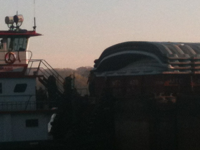
Day 38: S 10/20- Davenport Dave
We made it through lock 14 first thing in the morning. We paddled through the quad cities making good time on the mostly sunny day. Once we got through lock 15 we decided to stop at the Davenport Municipal Park to walk in to a Save A Lot to resupply. The park was really nice and the parking lot full of sponsored fishing boats scouting the area for a tournament coming soon.
As we crossed the road away from the park, the clean sidewalks, beautiful shrubbery, and benches every fifty feet was instantly replaced by a path grooved in the dirt, littered with trash, and a chain link fence to the side. We had found the low income side of Davenport. This hypothesis gained more and more evidence the closer we got to Save A Lot. Our very worn and weathered appearance fit right in.
When we returned to the canoe, we refilled water and decided to make some lunch. While eating our PBnJs , we had the pleasure of meeting fellow adventurer Dave. He was temporarily extending the dock for the fishing tournament. We chatted and he told us about when he thru hiked the Appalachian Trail, went down the boundary waters, and lived in Colombia. We exchanged stories, chatted about gear, and he gave us some tips for the AT.
When we parted ways, we made our way through some more barge territory and camped at toward the end of it on a great sandy beach of the refuge. A mile before camp we noticed one of the barges was leaking liquid in a pretty good stream. A tug was crossing in front of us and was
About to grab a different barge when he too saw the leak. He darted back across the river in front of us to
go and get a closer look. I wonder what he did to fix it and what was leaking? We would see him again the next morning.
Day 37: F 10/19- Le Claire
After our very short Thursday we were ready to put good miles behind us. The wind had died down significantly and the day was quite pleasant in comparison. We were nearing the end of the Refuge land and small towns were becoming more common. We passed several throughout the day before stopping in Le Claire, IA.
The town had a very cute riverfront with a large park and visitors center. There was a covered pavilion where we refilled our water and plugged in the phones. We found a Casey's general store in google, but didn't realize it was just a gas station chain. Aaron wandered up there and got me a pair of gloves and some beverages, but there weren't any reasonably priced groceries. He tried the BP on the next block with no luck and found out there was a grocery store about a 1/2 mile further down the river. We decided to paddle that way and see if we we would have time to stop before making camp. We did see it as we passed by, but dusk was closing in and we weren't in desperate need of anything so we kept going.
Once again we camped just outside of a lock, number 14, at mile 494. The warm dry day we had decided to turn wet as we paddled up to camp, of course. It didn't rain hard, just enough to get us and our gear good and damp before bed. But, we made 28 miles and paddled through some pretty natural areas and saw some cute little towns.
For our history class followers, it looked like Le Claire and the quad cities have some interesting history. Aaron and I can't do much research out here, but if you guys would like to research anything we mention, please feel free to post what you learn on here. We, and the other people reading, would love to learn more about these things! Just a thought, if you have time... Oh, and we'll try and get more pics of Lilly playing. She really loves her Jolly Ball and to climb trees. She'll climb anything at an angle and has actually gotten stuck a couple of times and Aaron had to rescue her. Super cute.
Day 36: R 10/18- Shortest Day
We got up, broke camp, and loaded the canoe just as a barge started pulling up to the lock. :( We knew that the process would probably be another two hours, so with no camp, we just hung out and killed time. When we saw the tug finally get into the lock, we paddled around and pulled the signal cord. It was a slightly premature decision as we then had to try and keep our canoe in one place with the winds rising.
When it was finally our turn, we paddled hard to get into the lock but it still took us forever. Exiting the other side was even worse. With thirty plus mile per hour winds howling into our teeth, we slowly made it past the dams guide wall. With a slight cross angle added to the wind it was all we could do to keep the canoe from running ashore. Alas, it did run ashore a couple of times before we decides that we just weren't going to go anywhere that day.
Since we heard the weather was only going to get worse, we made a strong camp a hundred yards inland. I even made a pretty snazzy, wig wam, canopy, shelter by bending over and twisting saplings together. This would give us a protected place to sit and enjoy a fire despite the elements.
Sadly, we didn't use it or the stack of firewood I collected very much. We hung out until about 4:00 and then went to bed way early.
One lock, and one mile forced our shortest day so far and hopefully for the trip.
Day 35: W 10/17- Beaten by a barge
Wednesday brought another overcast, but warm day of paddling. We were still headed through the Upper Mississippi Wildlife Refuge and it was mostly woods and small islands with a couple of small towns scattered through the day.
As we consulted the maps in the morning we decided to take a short cut leading up to lock 13. Pool 13 is full of small islands on either side and the channel runs through the middle of the for the most part. We decided to stay on the west bank instead and skirt around most of the islands, hoping to cut off a couple of miles.
This route took us through prime bird hunting spots and we saw several boats pulling in and setting up as we paddled through. We came through early enough not to get in the way and were back into the channel before the evening shooting started.
After we rejoined the main channel the visibility was rather poor. It was starting to get a bit foggy-misty-rainy and we weren't sure exactly where the Sam was until we were quite close to it. It finally decided to rain as we were a mile or less from the dam, but it was pretty light and not too cold so we were ok.
We had planned on getting through the dam just before dark and setting up on the other side. But, alas, as we finally got close enough to see the lock we also saw a sneaky little barge approaching from the south. At this point it was too close to dark to wait or him to be locked, so we had to camp on the near side.
There was a small peninsula off the to the left of the dam, but everything on the channel side was high Rick embankment, no good for beaching our beastly canoe. We paddled around to the other side, but it was full of lotus and marsh grass so we had to wrestle it up through that to get to the bank. By the time we got unloaded and were setting up the rain had decided to really come down and brought along its friend wind as well. We were pretty well soaked and a bit disheartened by the time we got in the tent, but dry clothes, warm sleeping bags and some chicken noodle soup did us wonders! We did check the maps and see we had made 29 miles for the day which made us feel better. We got to sleep early as we listened to that pesky north bound barge make its way through the lock.
Day 34: T 10/16- Jolly Ball
We left our camp and paddled straight into a heavy headwind. The temperature was warm enough and since it didn't rain, we will count this as a good day. The wind did slow us down a good bit though, only making 22 miles for the day. To avoid some crosswinds we left the channel midday and went down the Bellevue slough. To the left of the slough was Scott Island where we decided to have lunch. Afterwards we continued on through to lock 12. While we were passing the last little island before the dam, I saw a red ball sitting in the muck by the shore. We decided to go and check it out. When we got close, I saw that it said jolly ball on it which was one of Lilly's favorite toys at the daycare. So I waded through the slim and pulled out this half submerged ball that was split on one side and full of sediment. Lilly was already getting excited. After scooping the filth out with my hand and giving it a quick rinse, we continued through the dam. When we made camp that night, Lilly was overjoyed with the find. We played with it rolling across the beech until after dark and then again the next morning. Although it is bulkier than a tennis ball, it's size is proportional to the amount of fun Lily is getting out of it.
Day 33: M 10/15- Dubuque
**hey everybody, sorry it's been so long. We're doing fine and the monster storm out east hasn't affected us other than cooling things down a bit. Gonna try and bust out as much as possible on this battery charge. Thanks for following and your patience!
So, this was a while back so it's tough to remember the details. It was a warmer day than Sunday and we were down to tshirts and tanks for a while, at least while the sun was out. Coming up to lock and dam 11, mi 583, we passed through another larger pool. The wind wasn't too bad though, so we weren't really slowed down.
The dam went smoothly and we didn't have to wait for any barges, then we went through Dubuque, IA immediately afterward. The river was getting larger at this point. Generally it narrows down a bit and quickens up for a while after a lock, but this area was still rather large, 1/2 mile or so across. Like most towns and cities along the river, there was a lot of industrial plants and barge traffic. For some reason it also smelled strongly of chlorine, so don't know what's up with that. At least it didn't smell like dog food (yeah, I'm talking about you Newport).
We had a few more miles to go and made camp on an island at mile 574. We ended up going 31 miles for the day, which is always nice!
Day 32: Sn 10/14- Ferry Race
The day was another cold and wet day, but the wind wasn't too bad. Amazing how removing one of those three elements can make things better. We made our way through lock #10 and carried on with a pretty good pace.
As we approached a turn we saw a tug coming up the channel so we moved over to the inside of the river. Much to our surprise he continued to come straight toward us! We were well out of the marked channel, but now he was as well. We were still a hundred yards ahead of him when he finally turned into the shore and started lowering a ramp. This is when we figured out the it was a ferry. Two cars drove up on it and one of the crew walked toward what looked to be a bathroom. We decided that this would be a good time to try and go behind it. After we were already committed to crossing behind it, the engines engaged. So we paddled hard to finish getting around before he backed up. All very nerve racking. Once he pulled out, and returned to the channel, we kinda raced parallel with him in the channel and us to the side. We kept up pretty well with our little head start, but he was just about to nose ahead of us when he turned off to the other shore to unload. An exhilarating and slightly freighting experience altogether.
We made another mile or two down the river before calling it a day. We made twenty-eight miles dispute the cold and rain, and made camp on the Iowa side just south of Cassville, WI.
Saturday, October 20, 2012
Day 31: S 10/13- A bit of a breather
We started our Saturday at 648, and didn't end up too much farther down by the end of it. It was kinda, sorta raining when we woke up and we could hear distant thunder. By the time we made breakfast, tho, we started seeing lightening and the rain started coming down for real.
We decided to wait it out for a bit an crawled back into the tent. We were probably being overindulgent and were looking for an excuse for a break, but oh well. We finally broke camp and took off around noon and headed for Prairie du Chien, WI to resupply. It was only 11 miles down then we had to go down the alternate east channel to get to town. By the time we got to the landing it was nearly five already ad we were losing daylight. We power walked the mile into town and stopped at the Piggly Wiggly and found everything we needed, including dog food for Lilly.
It was still dusk as we returned to the canoe, but the light was pretty well gone by the time we pushed off. It ws an overcast night as well, so it was almost impossible to see where we were headed. We made it across the east channel and fumbled our way to a campsite. We made an astounding 11.3 miles that day, but it was worth it for a chance to sleep in.
Day 30: F 10/12- Island Hopping
We made good miles in the morning through a little wind, but were able to stay on the leeward side and sheltered in the river. As we started heading through Lansing, IA the winds took a turn for the worst and slowed us down considerable. Luckily we have had lots of practice at this point paddling over rolling waves. We filled the our empty water bag with river water, converting it to a ballast bag, and carried on. The waves continued to grow as we approached the pool created by lock #9. We seemed to entertain/worry some fishermen as we crossed the river to avoid crossing straight across the little lake. We made our way down the west shore and the tried our best to hop behind islands to avoid beings in the open water as much as possible.
We were sheltered better going down the east shore as we approached lock #9. We made camp less than a mile after the dam, making twenty-four and a half miles for the day. Not great, but reaching our goal. It was a well sheltered spot as we expected thunder and lighting the next morning and wanted to be prepared for the worst.
We were sheltered better going down the east shore as we approached lock #9. We made camp less than a mile after the dam, making twenty-four and a half miles for the day. Not great, but reaching our goal. It was a well sheltered spot as we expected thunder and lighting the next morning and wanted to be prepared for the worst.
Day 29: R 10/11- Everything will be perfect in Iowa!
The wind picked up through the night, which we hadn't expected, but it didn't rain. We had staked down the tent corners, but not the rainfly so it flapped and snapped through the night. Even so, it held up well to the strong winds and was roomy and comfortable. The next morning as we were packing, however, after we had taken all our gear out the wind pulled up the stakes and sent the tent tumbling over a time or two. We leapt up from breakfast and raced it down and it was no worse for its gymnastics.
We headed out and through La Crosse first thing and got to fight a bit of that lovely wind throughout the day. It was kind enough to be blowing in the right direction and pushed us right up to the next lock and dam, # 8. We had been passed by a small house boat pontoon a couple of hours before and were surprised to see them circling around in front of the dam. There was a barge sitting in the exit area, heading up river as we approached that just started pulling out as we got there. We snuck to the far left and hid under a railroad bridge while he came out. He 7 or 8 barges stacked deep and three wide, the biggest we had seen yet. As soon as they were out the pontoon raced in an we followed as quick as we could through the tug wake. As we were being lowered the guys in the pontoon said they had been waiting nearly two hours for the barge to finish locking!
After that we made decent time through a chilly, but not too windy, afternoon. We stopped to check the maps early afternoon because there was an island called Gillette Island we wanted to stop on for lunch. Turns out it was just around the bend, the next island down. It was a very pretty little island with a very picturesque cove that made for a nice lunch spot. Aaron snapped a pic as we left.
After that I was freezing and about ready to call it, but we decided to make a break for the Iowa border before stopping. Aaron assured me that "Everything will be perfect in Iowa" but then followed up with "I bet you could count in one hand the number of times that's been said, ever." It was pretty cool to cross into the new state though and we made camp just down river after a 27 mile day.
Day 28: W 10/10- A post office stop and a sunset
We headed out and got through lock 5A in the morning. We made good miles through the pleasant weather and stopped in the little town of Trempealeau tucked between the river and some bluffs. We stopped at about 13:00 immediately after going through lock six and headed for the post office. The Petersens had sent us a new tent along with some jerky. While I liked my old tent, I did have to admit that it leaked like a wicker basket. Hopefully this one will do a better job at being a tent. The town was small enough that there wasn't a real grocery store so after we picked up our package went straight back to the canoe, had lunch on the dock, and carried on to get some more miles done in the sunshine.
We made it through lock seven later that evening. The lock master was a jolly fella who encouraged us to paddle hard to stay ahead of the weather. We made camp on a high sandy beach just outside of La Crosse. Thirty-one miles and three locks done put us in elevated moods. While the spot seemed to be frequently used amongst the locals, (a fair amount a trash) the sunset view that it provided was unrivaled. The rays of orange sun shown through the clouds that tricked over the bluffs before dancing across the wide river all the way to our feet. Bob Ross would probably sell his mother to paint something a tenth as beautiful.
We made it through lock seven later that evening. The lock master was a jolly fella who encouraged us to paddle hard to stay ahead of the weather. We made camp on a high sandy beach just outside of La Crosse. Thirty-one miles and three locks done put us in elevated moods. While the spot seemed to be frequently used amongst the locals, (a fair amount a trash) the sunset view that it provided was unrivaled. The rays of orange sun shown through the clouds that tricked over the bluffs before dancing across the wide river all the way to our feet. Bob Ross would probably sell his mother to paint something a tenth as beautiful.
Day 27: T 10/9- Another cloudy day
After our short day on Monday, we were ready to make some good miles and were ready for better weather any time. It felt like a moving target tho, every time we checked, they had extended the rain and cold another day or two.
Luckily tho, Tuesday never delivered any real rain and we made good time through more refuge area. We were surrounded by large hills with exposed cliffs covered with fall trees.
We stopped a couple of miles before the next lock and dam on an island off to the side of the main channel. The other side was a marsh like cove filled with ducks and geese, chattering away. We found a dry-ish spot and set up the tent. They called for rain in the night, so we tied the tarp over the tent as well, just in case. Ended up not raining at all, as far as we could tell, and we woke to a sunny morning filtering through the trees.
Day 26: M 10/8- Short but Productive
We woke up the next morning to find that the winds had shifted into a monstrous headwind that was also angled from the easy side of the lake. This created some enormous waves and slowed our speed to a little over a mile per hour. Toward the end of the lake we found another little creek delta peninsula and stopped for a little while to rebuild our strength, moral, and courage. This short break ended up taking the better part of two hours before we returned to our vessel to play an intense game of teeter tooter with rolling waves. It took us about an hour to clear the rest of the lake.
In the river we were fighting the same wind but with less distance for the waves to build. It was still slow going, but we eventually made it to a little park in Wabasha. We found that they had bathrooms with a shower and a little market a half mile away. Even though we were way behind schedule, we decided it would be better to take this opportunity to shower and resupply rather than pushing into the headwind at a mile and a half an hour. We also found a little pavilion with power that we were able to charge the phones at.
After our town wind and town breaks, we headed down river another mile or two and camped on a island. We made a whooping 11.5 miles today, but was happy to have shed a layer of filth and power up I'm Wabasha.
Sunday, October 14, 2012
Day 25: Sn 10/7- Lake Pepin, part 1
The next day we had to brave Lake Pepin, a 20 mile lake that stood between us and the next dam. It's a narrow, winding lake nestled between the hills and bluffs. We made great time through the 11 miles leading up to the lake. The wind was mild-ish in the river and it was a good deal warmer and sunnier than it had been.
As we came into the lake itself we began to feel the wind that was blowing across such a large body of water. We had to paddle hard to get to the W shore which was a bit more sheltered. As we made our way into the lake proper we passed a sandbar covered with big white birds. We thought they were pelicans at first, then storks, but honestly aren't sure. If someone could look up if either (or both) of these are found in southern MN, maybe we could clear up the debate- a Mr. Terpstra's class assignment perhaps? We took a couple pics of them, but i don't think they're real clear.
After we made the W bank we were fairly sheltered, but the lake was full of coves and bays nestled between the hills. To stay out of the wind we had to go a fair bit out of the ways of the main channel which slowed us down, of course.
We stopped for lunch at a pleasant little beach in the sun on a stretch of state land in the late afternoon. There was a but of sun and quite a few sailboats out playing on the waves. We decided we really liked Lake Pepin, with its high bluffs and quiet coves.
The rest of the afternoon we crossed a couple more bays, always fighting a cross wind from the right, the west. The last, and longest was exhausting and we just got across it before dusk. We were so focused on getting as far down the lake as possible we failed to check if there was suitable camping. After the last cove, 2 miles or so at the town of Pepin, MN, we realized we were in a tight spot. There was a steep embankment, then a railroad then a major highway running along the remaining 8 miles of the lake. We checked google maps, yay iPhone. And found a little spur of land about a mile down that might work. It turned out to be a creek that ran under the road and tracks and formed a small peninsula into the lake. It was only 100 yards or so long and about 50 across, but the trees and such gave enough cover to set up the tent and build a snug little fire. Even with the train running close by we were quite cosy.
**Just a quick aside. We'd just like to thank everyone who is following out progress! The support for our trip from our family and friends has been unbelievable and we really appreciate. Just so you know, every view and comment encourages us in our trip. We know we've had trouble keeping up-to-date and we appreciate your patience with us. We try to at least let our folks know we're still hanging in there and if there's a gap it's just a lack of energy, for the phone or for us. Anyway, thank you all, it means the world that you're along with us for the ride and please drop us a line when you can.
Saturday, October 6, 2012
Day 24: S 10/6- Got Swamped
We took off the next morning with a nice tailwind. The crossing to the dam through the reservoir pool was a little nerve racking with roller barely breaking at the gunnel. The lock master saw us coming a ways out and filled for us before we got there. It was a nice, quick experience. He told us there was another group from Australia maybe that was 45 minutes ahead of us.
We made quick miles down the river mostly dealing with a speed freak yacht club. When we stopped for lunch, two racing yachts speed by and swamped our canoe which put me in a bad moods. The rest of the section was pleasant. We made it through lock #3 and stopped a half mile away on some state land and made a nice little campsite. We chatted with couple of fishermen who I was happy to run by there house the next day; sadly to find out that they only pulled in a 5lbs. catfish. Nice couple of gents though.
We made quick miles down the river mostly dealing with a speed freak yacht club. When we stopped for lunch, two racing yachts speed by and swamped our canoe which put me in a bad moods. The rest of the section was pleasant. We made it through lock #3 and stopped a half mile away on some state land and made a nice little campsite. We chatted with couple of fishermen who I was happy to run by there house the next day; sadly to find out that they only pulled in a 5lbs. catfish. Nice couple of gents though.
Day 23: F 10/5- Newport
Unfortunately, Aaron woke up in the middle of the night to a very soggy bedroll. He, his pjs and his sleeping bag were soaked. He changed into dry pjs and tries to huddle under the dry corner of the bag, but it was an uncomfortable, and confusing, experience. Apparently Lilly had decided leaving the tent to go potty was just too daunting and had made the tent her bathroom. Yuck!
So, after the wind and cold of the last few days we had to stop after a couple of miles that chilly day and walk into Newport, MN to do laundry. There we were, dressed like bums, dirty and bedraggled, carrying two garbage bags of laundry down the highway, one of which smelled suspicious. We found the coin laundromat and hung out outside while the wash was in, trying not to look too suspicious and mostly failing. We got our things clean and repacked and hoofed it the 2 miles back to the canoe.
From there we didn't set our sights too high and went about 10 miles total to a stretch of state land. The MN dnr maps showed a primitive campsite, but we couldn't find it. We did find a sheltered little meadow on a point between the river and a lake and finally made decent camp. We had a nice little fire and made a hot meal for the first time in a few days. All in all, lovely.
Day 22: R 10/4- First locks & a new river
We left Banfill island as early as possible, without breakfast. We paddled hard into the wind and stopped at a little access for a cold breakfast. We made it a quick stop because the access offered no break from the wind and we had a big day ahead of us.
Paddling through upper Minneapolis was a lot of industry. A little bit dingy with a lot of graffiti. The wind was strong and coming from the west, which tired my left arm significantly from trying to keep the boat straight.
We finally made it to our very first lock! We were nervous that we would screw it up, and maybe we did. We found the signal rope and gave it a pull. A voice came over the speaker, telling us that it would be fifteen minutes or so. We backed up to a walkway thing so that we could hang on with our having to constantly battle the wind. The traffic light blinked red for a while and then turned off which confused us but we decided to hang tight. After 45 min we decided to go ahead and signal again. We received the same response essentially. This time the gates did open and we entered and were dircted to some ropes for us to hang on to. One of the workers eventually came over to tell us that we shouldn't leave after pulling the cord. We told him that we hadn't and he then apologized and told us that they had lost sight of us. Altogether it was a pretty simple experience, one that would occur again another few hundred yards down the channel. This time we got through sin 20min, without a hitch.
Paddling through the rest of Miniapolis was pleasant park scenery starting into so rock bluffs and more interesting graffiti under every bridge.
While the first two locks were the St. Anthony Locks, we would also be going through the Army Corp of Engineers Lock and Dam #1. We made it through this without a problem as well and got to chat with the guy working it for a bit. Out of the dam, it was back down the familiar river to St. Paul, although the river now contained buoys and barges.
Entering St. Paul by the river was very pretty, although the wind was still serving us a good bit of grief. We went by several cool paddle wheel boats and traversed through a marina, which offered many more interesting vessels to view. Eventually we came out of the beautifully manicured and graffiti free section, dropping us in the middle of dozens of tug boats and barges line both shores two to five deep for several miles.
The wind was growing fierce and we were already exhausted from the day, well short over our expectations. My left arms was struggling to work through muscle failure, and the light was retreating its final rays through the smog of St. Paul. We needed to find a place quickly.
We knew there was state land on a peninsula on the left side of the river. Eventually the line of moored barges broke and we took to the shore. The wind had developed into a monster, so we had to find some cover for fear the tent poles would snap. We found a spot just big enough at a little low point behind some high vegetation that we would refer to as the hole. With no fire, cold but protected; we made some Raman from the door of our tent.
While the day was full of trials from locks and barges to winds and poor camping location, we made it through and began a new section of river. Different from the river we knew before, we are out of the shallows, sand/gravel bars, and wonderful little DNR campsites and on to the big river.
Day 21: W 10/3- Sketchy camping
We had a big day ahead of us. We were coming up on Minneapolis and had a post office run an a dam to portage before the day was done. We left early and it was fair weather coming into Elk River, 881. We pulled off and tied the boat by a small park at a rocky embankment. The town was surprisingly large and the post office was about a mile and a half walk. We picked up our package, which had the usace maps and another small dry bag and set back.
As we came up to the Coon Rapids dam, the water backed up an widened considerably. We paddled through some very ritzy areas, the houses would put Torch Lake to shame. We had planned to camp on an island just beyond the dam, but as we made our portage we realized the 'state land' we had seen on the map was a very nice park, filled with people.
We finished our last portage, hurray!, and decided to paddle down to another island, Banfill, a mile or so down, 861. The map showed it was owned by the University of Minnesota as a natural preserve and there was no camping allowed, but with day light almost gone, we had no choice. We were definitely in the suburbs by then and even baked into the island a ways we could see across the channel into a little subdivision. We didn't light a fire and ate a cold dinner. We were in bed early and nervous that some busy-body was gonna snitch on us for being out there. But, we got through a restless night and were gone the next morning at the first-ish light of day.
Day 20: T 10/2- Monticello
The weather was fair, a little windy, but mostly blowing in the right direction. We cruised through the 18 miles to land us in Monticello at the Bridgeview Park. We did stop after 10 miles to eat lunch at a tiny little sliver of an island. It was fairly tall but only a few hundred yards long and maybe thirty across. It was an actual campsite too, but with only enough room for maybe one tent. It was quaint, had a gorgeous view and a picnic table, which made for a relaxed lunch. When we made it to Monticello, I made the short 3/4 mile trip into the grocery store to refill on some basics. After that we made the last seven miles and camped on a Dimmick island, no campsite but available for primitive camping.
Day 19: M 10/1- Sauk Rapids, woot!
We had about 9 miles to the Sartell dam, 929. Each dam creates a bit of a deeper reservoir that helped us avoid gravel bars and riffles, which was nice on such a low water year. So we came to the dam midmorning with no troubles and at a pretty quick pace.
The portage was only 300 yards on the right, but the reentry was a steep slope of huge rocks and was way too close to the dam for comfort. So we scouted a fair ways ahead and found a highway bridge that had a much more gently slope underneath, about 1/4 mile farther down.
We passed a couple of young guys heading out to fish who warned us of some really shallow areas ahead and advised us to 'go right at the split'. We thanked them for the advice and found it to be pretty good after we put back in. We still fought low levels and rocks and had a few heart stopping scrapes, but ultimately avoided any holes in the boat, yippee! Then we got to Sauk Rapids.
The map warned that there were Class 1-2 rapids for a stretch through town and that the town provided a portage around, if need be. Unfortunately, the water was so low we couldn't have made the portage if we wanted to and had to were forced to shoot the rapids. And, it was a blast, a tooth-clenching blast. I'd say it was a fair bit more than Class 2, complete with boulders and white water, but at least there was a path. We'll take big rapids over ankle deep riffles any day! We knocks into on big 'un on our way though, with no damage done and rode a nice adrenaline rush for the afternoon.
We had three miles till the st cloud dam, which was easy and pleasant, though the reentry was down a long, steep set of stairs. The folks who worked in the park, Rosie and Bill, we're kind enough to come out and offer to help. Rosie refilled our water for us and Bill help carry out beastly boat down the steps. The Rosie surprised us with some snacks and treats to send u on our way. It was incredibly nice of them and certainly lifted our spirits. If you guys are reading, thank you so much. Crazy people like us are lucky there are nice folks like you on the river!
From there we made for Boy Scout's piping campsite, 913. We had an easier time with rocks and made it there with about an hour of light left. It was on the inside bend of the river on the W bank and the other side was high hills with a few big, ritzy houses tucked into the woods. We heard some hootin and hollering from some kids across the river and saw a couple of other campfires. A the night wore on we heard what seemed to be baseball sized rocks being launched into the river with a catapult. We thought maybe the locals were messing with us, but eventually decided it was just fish jumping. Giant, man-eating fish.
Day 18: Sn 9/30- Short Day/Deck
Today was a pretty pleasent and uneventful day. The weather was beautiful, so we saw a bunch of other people out enjoying the sunshine. We had to call it an short day after only 21 miles, because that was the last campsite for a ways.
We enjoyed the rest of our afternoon at camp in the sun at Stearns County Watercraft Campsite. We watched the boats go by and played a bunch with Lily. We finally got out the deck of cards we had brought only to realize that it was a pinochle deck. We decided that it was fitting, since anyone wanting to make this trip must not be playing with a full deck.
We enjoyed the rest of our afternoon at camp in the sun at Stearns County Watercraft Campsite. We watched the boats go by and played a bunch with Lily. We finally got out the deck of cards we had brought only to realize that it was a pinochle deck. We decided that it was fitting, since anyone wanting to make this trip must not be playing with a full deck.
Day 17: S 9/29- Shallows
Day 17 took us past the Camp Ripley Military Reservation, a 20 mile stretch on the W bank. This stretch of river had a bunch of islands in the channel. According to the MN dnr, these islands are a result of logs catching on shallow areas during the last century of logging and the subsequent build up of sediment. They were interesting to paddle by, but had the unfortunate effect of widening the river and creating shallow riffles. If the water were higher, even by a foot or so, these areas would be no problem. This year, however, the river is the lowest it's been in about 50 years. So, we spent the day paddling Ina river a quarter mile wide that had enough water for something 200 yards wide. We had to get out again and walk through some shallow areas, wondering if there were some army grunts in training laughing at us on shore. Luckily it was super warm and walking in the water was pretty pleasant.
We were aiming for the Pike Creek landing, at mile 960, for the evening. First we had to go over the Little Falls dam at mile 962. The portage out was just beyond a bridge and fairly easy to get out, and the path was through a nice city park with paved trails. The othe end was a series of wide, deep concrete steps then a few feet of rocks. We were able to carry it down the steps okay, but getting over the rocks were a challenge. My back has been hurting on and off, but with Aaron on the heavy stern end and me on the bow we manage to wrestle it over the rocks. We had a bit of an audience, who gave us encouragement on our way down, which was nice.
After every dam we were a bit nervous because the water is lower and rocks become a huge issue onec again. This time, though, our way wasn't too bad. There was only a few miles till our campsite and no bad rocks to slow us down.
The site was tucked up Pike Creek on the W bank about 300 yards in the Charles A Lindbergh state park. The Mississippi is low, the creek was barely paddleable. We finally wormed our way back to the site, pretended to ignore the self-registration payment sign and camped in a very cute little nook.
The pics aren't very good, but we tried to show just how low the water was. From that point we walked/dragged the canoe over 1/2 a mile.
Day 15: R 9/27- Short day
We had big plans to do a 30-some mile day and got and moving pretty well that morning. It was a warm, sunny day and our first dozen miles flew by. We experimented with the kayak paddles. They seemed to move us along at a good clip, though it took some more to get the boat moving. It definitely uses a different set of muscles using kayak paddles instead of canoe. We each tried it for a 1/2 or so at a time and it helped, but we'll have to work up to using them for longer stretches.
After those first miles we entered a reservoir with several islands and sand bars dispersed throughout. After getting a bit turned around and slowed down quite a bit due to wind, we stopped at Green's pt landing, 1006.9, for lunch. It was close to 2 at this point and we realized we wouldn't make our mark that day. Lily was almost out of food and we had to stop in Brainers and walk to the Walmart, almost 2 miles. That and there was still a dam, Potlach 1000.7, to get through before our intended campsite. We were out of time for so much, so we picked a spot on the far en of the reservoir instead and left the Sam an shopping stop for the next day.
After a bit more confusion on how to get out of the reservoir, we looked for a likely spot on a small stretch of state land on the southeastern end of the lake. As we were unloading we saw signs for cross county ski trails and realized we were right on top of them. We knew we probably weren't supposed to camp there, but we didn't really have other options, so we'd jualst cook with the stove, no fire and get up and gone early. There was one jogger who came through and got a loud and terrifying welcome by Lily. He was okay about being almost-mauled by a rather large canine, but it got us a bit sketched out about staying there.
So, we were in bed early and quietly and didn't get the best night sleep. We had only made 16 miles, but we took it for a break and resolved to get back on track the next day.
Subscribe to:
Posts (Atom)