Saturday, December 8, 2012

Day 77: W 11/28- NPR & Vicksburg


  This time we were ready to go.  A day of relaxation in the tent had generated more trash and mesh than we had realized and breaking camp was a chore.  We also had to collect the chairs and our rain gear, which we had stashed under the rain fly, from along the windswept beach.  The weather was chilly and breezy, but a far cry better than the day before.
  We made up for our lazy day by making 35 on Wednesday and camping at mile 433 just south of Vicksburg, MS.  We listened to NPR all afternoon, which was a nice treat.  Reception is rather spotty on the river and usually we’re stuck with static.  There were several casinos in Vicksburg that we joked about stopping at, but once again paddled passed for a night of rice and pasta.  The sandbar we stopped on was very shallow and we were lucky the water didn’t rise at all during the night.

Day 76: T 11/27- Zero Mile Day


  At this point in the trip we thought we were beyond the possibility of zero-mile days.  Even in the nasty weather of the north, we had always managed to break camp and at least push the canoe out, even if it was only for a mile or two.  This morning, however, the wind was still blowing hard and we were exhausted.  At first we decided to wait it out, try and sleep and take off around noon.  We snacked in the tent, dozed and by noon had no more ambition to move that we had at dawn.  We finally resigned ourselves to a day off and spent the afternoon reading and cuddling with the dog.
   We did manage to eventually leave the tent to make dinner and call home, but it was chilly enough that we retreated to the tent pretty quick after dinner.  The thunderstorms they had called for had pretty much blown themselves out the night before, but the wind and cold alone was unpleasant.  With nothing to do and no flashlights, we were asleep early after a much needed day off.

Day 75: M 11/26- Stormy Night


  We hadn’t heard any rain during the night, so of course it started sprinkling as we woke up.  It was off and on and we managed to break camp and made food during the dry spells.  During the day the rain continued off and on, but we were well bundled up and the weather stayed pretty warm.  The weather called for thunderstorms and high winds on Monday night, so we tried to look for a sheltered camp.  
  Unfortunately, our timing was off and we had to go around one last bend to find a suitable camp.  By the time we were able to pull off, it was getting dark and we had to take what we could get.  That left us an open sandbar next to a lagoon with a huge dead fish.  We made camp and food with no trouble, but woke up around 10 when the side of the tent tried to attack Aaron.  We spent the next hour or so splayed out holding down the tent with our hands and feet.  We were able to batten down the corners with water bottles and eventually the wind died enough for us to sleep.
  And then it changed directions and it was my turn to get tent suffocated.  This time it didn’t die down and the entire night was a lesson in tent staking.  Aaron eventually made a dash through the rain to the canoe and brought all the paddles we had.  He put the handles through the tent loops and dug the blades in as far as the would go.  This kept the tent on the ground, for the most part, but the wind still wouldn’t let us have a good night sleep.  By morning we were more tired than when we had gone to bed, but at least the tent was still a tent and we were still dry.

Day 74: Sn 11/25- Louisiana!


  After the short day and our Greenville stop, we wanted to make good miles on Sunday.  We ended up going 31 miles, which seemed to fly by.  Paddling for hours on end can become very tedious, so a day like that was a nice relief.  We camped on the MS bank, along an abandoned field that was becoming overgrown.  The weather showed impending rain, but the evening stayed dry.  The day was mostly uneventful, but we did finally make it to the last state of the trip, Louisiana!!

Day 73: S 11/24- Southern Hospitality


     We were just a few miles from Greenville, MS that morning and we decided to stop to resupply while we could.  We stopped at Warfield Park, a large camping and picnic area with water and a charge.  Google said the closest place to shop was a few miles away at a Kroger, so Aaron took off walking while I stayed with the dog to charge the phones, blog and refill water.  After what seemed like ages, Aaron came riding along in the back of a pickup with two nice ladies, Martha and Judy. 
Apparently the Kroger was a Google maps myth and he had ended up walking about five miles to find a grocery.  On the way back, heavily laden with bags, these two ladies had seen him and offered a ride back to Warfield.  They had been picking up pecans in their front yard and sent us along with a bag of those as well.  They were incredibly sweet and we won’t forget their help!  We exchanged contact information and promised to get in touch when we made it down to NOLA.  They also gave us a pack of cola and even some cash so we could get ourselves a real dinner at some point.  After chatting a while and hugging farewell, which is a miracle in itself considering how good we smelled, we packed up the canoe in high spirits.  Those pecans were our favorite snack for the next couple of weeks and we were sad to see the bottom of the bag.
The trip into town had taken so long that we didn’t get going until late in the afternoon.  We stopped at 532 after only going 11 ½ miles, but meeting Martha and Judy, getting water and power and fresh supplies made it a very nice day.

Day 72: F 11/23- Tricky Camping


  We left from 572 ½ the next day.  It was still pretty warm, but the wind had steadily picked up over the previous couple of days so paddling was a bit harder.  We were padding more houses on the MS side, but AR still seemed pretty bare.  Finding camp that night was a little tricky; first we tried a sandbar on the AR side which turned out to be mostly gravel and too shallow to beach safely.  We could see a nice looking sandbar on the other bank, but the river is too wide to see detail across the water.
  When we got over there, they first spot was too steep to make camp and the next one had a deer blind with hunters in it.  We went a few hundred yards down and pulled up onto a steep sand bank broken by deep ravines from rain runoff.  That night we heard then saw a pickup drive by on a two track very close to our camp.  We figured they were the hunters leaving, but were not sure if they had seen us.  No one bothered us, but we had a bit of a restless night.

Day 71: R 11/22- Happy Thanksgiving!


  Happy Thanksgiving!  Our holiday was pleasant enough, though no kind fisherman offered to take us home for a nice home cooked meal.  We did come across several fishing boats and their trailers at a ramshackle fishing camp.  One boat stopped to chat and see where we were heading.  They were two nice guys and their boat was chock full of spoon bills.  They said they had seen other paddlers attempting the trip in the past, but no one yet this year.  The day was warm and only slightly breezy, making for a pleasant day.
  We stopped for the night on a shallow sandbar on the AR side and prepared our Thanksgiving ‘feast’.  We had instant mashed potatoes with instant chicken gravy, instant stuffing and mini tuna casseroles.  Aaron drained two cans of tuna, added some milk and seasonings, covered each with a slice of American cheese and set them to bake in a coal-lined hole.  They were very tasty and the most complex meal we had had.  We finished it off with a fried peanut butter, chocolate and marshmallow sandwich each, delicious!

Day 70: W 11/21- Longest Day Yet


  Aaron and I grew up in the middle of nowhere, or so we thought.  For a major shipping route, there is an unbelievable amount of nothing on this stretch of river.  We would sometimes pass a hunting cabin or blind, but there was not a town to be seen.  The occasional large round hay feeder or stock tank sitting on top of the embankments would indicate a pasture, but we were riding so low, we didn’t even see much of that.
  The day was a great one, we did our longest stretch at 39 ½ miles, just short of the elusive 40.  We had thought about stopping on a sandbar a few miles up, but we had just enough daylight to make the next bend.  After that, we ran into barge traffic and the spot we stopped was right in the way and had no suitable spot for a tent or firewood, so we had to keep going.  We stopped in a small cove right at the start of an embankment; the sand had built up a nice little platform just big enough for our camp, but high enough we didn’t have to worry about the water rising on us.  The wood, unfortunately, was mostly up the embankment and Aaron had to scramble along the rocks at dusk to collect enough for our evening and morning fires.  

Day 69: T 11/20- Helena, AR


  At this point we were almost out of water once again and planned to stop in Helena to refill.  The small town has a couple of ramps, but they were tucked behind some industrial buildings and clogged with the inevitable barge traffic.  We made an improvised landing on the outside of the harbor and walked up, but there was no spigot to be found.  We didn’t want to walk all the way around the harbor into the town proper, so we settled for boiling more water and took off again.  For you history folks, apparently Helena was dubbed “Hell-on-Earth” by the Union army when they camped there.  There’s some interesting information on the town that may be worth looking up.
  After our stop we headed almost due south for several miles, fighting a stiff cross wind.  It wasn’t the worst wind we had fought, but exhausting nonetheless.  We ended up doing 28 for the day an camping on the AR side once again. 
  Since we haven’t talked a great deal about the natural surroundings, I’ll throw a note in here.  As we traveled down river, changes to the ecosystem were gradual and easy to miss over the long haul.  The nice northern woods were gone at this point and we traveled through strange trees and other flora.  The sandbars along the river were mostly bare and had bur bushes, some fluffy grass and sometimes scrubby bushes- you can tell I’m an ecologist, right :p  At the high water line, the trees were small and grew close together, indicating young growth for several yards into the woods.  Regular flooding of these areas inhibits long-term growth.  So, the forest always seemed dense, overgrown with weeds and not at all like the open woods we are used to back home.
  Wildlife consisted mostly of herons, deer, coyotes and small, burrowing critters.  And spiders!  There were an unbelievable number of eight-legged monsters all over the place.  They dug holes in the sand, built webs under our rain fly in a matter of hours and would float on the breeze across the river on thin lines.  These were the worst; the lines would coat our hair, arms, paddles and dog and once their lines were on you, you knew they had made it into the canoe.  We almost bludgeoned ourselves with our paddles trying frantically to kill the little buggers as they made a dash up our legs (by we I mean mostly I, Aaron wasn’t nearly as girly about it).  There were also big hairy looking guys with long legs who would float on the water until we came close.  At this point, they would pop up onto their toes (or the arachnid equivalent) and sprint to the canoe; we think they were looking for a ride or a meal, but we’re not sure.

Day 68: M 11/19- Coyotes


  As we broke camp the next morning, Lilly took off for the brush over the ¼ mile of sand bar, barking at two large coyotes who had come looking for water.  They paused for just a moment before darting back into the scrub.  After that, the day was pretty uneventful and we made camp at 665, another 33 mile day.  We stayed on Prairie Point Towhead just north of Helena, AR.

Day 67: Sn 11/18- Sunshine


  Sunday was a nice, full day with more sunshine.  The last several days we had been able to have our solar charger out all day and by the evening it was finally fully charged.  As we left the last of Memphis behind, we passed several industrial complexes and had quite a bit of barge traffic to deal with, but the paddling was smooth.  We were excited to pass the 700 mark as well as enter into Mississippi, the namesake of our journey!
  We stopped on the right bank at 698 on a tall sand dune across from a casino.  After a brief daydream of paddling across for a visit to their buffet, we settled for camping right at the rivers edge and watching the sun go down over the water, very pretty.  We plugged the phone into the charger and after the entire evening, it had actually fully charged the phone, so yay!  As long as there was ample sunshine, we might actually be able to use the phone regularly again.

Day 66: S 11/17- Land of the Delta Blues


  We left 743 early so we would have as much time in Memphis as possible.  We were only seven miles from the landing we were aiming for and made it there with no problems and little barge traffic.  As we passed under the I-40 bridge, we made for the left bank, only to find that our ‘boat ramp’ had obviously been out of commission for a while.  We managed to pull the boat up on to the concrete remnants of the ramp and headed up.  We found ourselves in a closed down park/convention center surrounded by barbed wire and under repairs.  We met a very nice lady at the gate who said it was fine to leave the boat where it was and that she’d be around to let us back in.  Unfortunately, the area had no power, so we couldn’t charge the phones and all three of us headed to a Save-a-Lot the gal directed us too. 
  It was a roughly two mile walk and the area went from high-end, riverside condos to rough ‘hood pretty quick.  I waited outside with Lilly while Aaron went in to resupply.  After what seemed like ages he finally emerged with a huge supply of groceries.  Since towns had become so scarce, we wanted to get as much as possible in Memphis.  We hauled our load back to the boat, stopping for a coveted Subway sandwich on the way and had lunch in the sunshine by the boat.  It took forever to pack everything away, but we’d be set for quite some time. 
  Afterwards we headed out, but only made another five miles and stopped at 731 for the night.  It was just 12 miles for the day, but we had a good resupply and were ready for a break after our town adventure.

Day 65: F 11/16- Helpful Duane and the Stinky Dog


      We left our camp, at mile 763, looking for spot to stop.  The river was large here, but the wind was gentle and we had pretty easy going.  There was one turn around 757 that was tight to the right and resulted in rough water where the river was choked up.  We stopped briefly to let a couple of barges by, then shot through as quick as we could.  After we got through the chop, another barge camp by headed north.  The turn was tight enough that we would have been trapped on either side of the river if our timing hadn’t been on and we got caught next to a barge.
     After that we made our way a couple of miles to the Shelby Forest boat ramp, figuring there would be some water supply and possibly a ride to town for food.  Turned out the ramp was almost five miles from the main visitors center and almost seven to the nearest ‘town’- it was as much a town as Kewadin is.  Luckily, as we wandered down the road back to the canoe, water jugs and dog in hand, a guy spotted us in his pickup and offered to drive us to his house to fill up water.  It was beautiful drive up through the Tennessee hills and the guy was friendly.  After we got our water, he drove us into the little town to a convenience store where we could at least get a few basics, cereal, peanut butter, eggs, etc.
       Our new friend, Duane, drove us back down to the ramp and we chatted a while.  He couldn’t seem to understand why people attempted trips like this.  Apparently we were not the first paddlers he had helped out.  He gave us some advice for our upcoming journey through Memphis and we were off.  
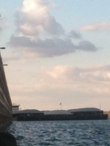
While we were away, a huge barge had come up and moored right by the landing, to take on a crew member. The barge had stopped just yards from the canoe and while we loaded up we had a good perspective to see just how huge they really are compared to an 18’ canoe.  After he pulled away we hopped back in. 
Our goal was to get as close to Memphis as possible before making camp.  We had gotten enough food to get by a day or two, but would still have to stop in Memphis for a long-term resupply.  We stopped at 743, after just 20 miles on a pretty lagoon tucked between two dikes.  The view of the sunset was beautiful and we could just make out the Memphis skyline in the distance.  It took some time to gather enough wood, but all around the camp was one of the best.  We talked into the night and were excited for our foray into town.  And then the dog came barreling out of the brush, stinking.
She didn’t smell like skunk, not quite.  But that’s not to say she smelled good.  As soon as we caught a whiff, we called her over, hoping to keep her away from whatever smelled so terrible.  Too late.  She came over slobbering uncontrollably, white foam pouring from her mouth.  Aaron took off her now pungent lifejacket and wiped her mouth out as best he could, pouring water down her throat.  We wiped down her face, but she broke away and rolled frantically in the sand whenever she could.  Eventually she calmed down a bit and we were able to get her to drink water and figure out that she was ok, if rancid.  That night the stench in the tent was almost unbearable, but we couldn’t leave her outside for the cold and whatever critter smelled so bad.  We figure she stuck her nose down some burrow and its inhabitants didn’t want a 70 lb dog for company.  

Day 64: R 11/15- Low on Supplies


  At this point, we were getting pretty low on supplies.  We had been boiling water for a couple of nights, which was fine, but time consuming.  The weather was holding fine, the wind was light and it was relatively warm, a nice respite from 45 with a damp wind.  We tried several landings in the evening, but it was either too gravelly to land the boat or the beach was too exposed for a camp.  We finally pulled up on a sandbar and pulled the canoe up a steep little hill for the night.  The fishermen from the week before had warned us about the river rising in the night.  They said it could rise up to four feet and had just weeks before.  Since then we had been careful to pull the boat up as far as possible and to tie her off when possible.
  We had to haul our gear through dense brush to get to an open area farther up the beach.  It made us nervous going so far inland, possibly into private property, but it gave us a good windbreak.  We had to boil more water, so we had several trips back and forth through the brush before we were done.  That night we went over all our supplies and realized we were even lower than we thought.  We had 2 eggs, a few pieces of bread, a little peanut butter, dogfood and coffee.  We’d be fine for a day or two and could improvise, but we really needed to find a town.

Day 63: W 11/14- Arkansas!


  We had another good day and made a smooth 33 miles to camp at 796 ½.  Early in the day we passed out of MO and into Arkansas, another state down!  We made camp on a gravelly beach with little cover and less wood to burn, but the evening was warm and still so we made due.  We stayed up chatting for quite awhile, enjoying the night, but it made the next morning a bit of a challenge.  We found several cool stones and Lilly played on the beach with her Jolly Ball.

Day 62: T 11/13- Caruthersville Bust


  The next day we knew we needed to stop soon for water.  We were doing alright on food and such, but were down to our last jug of drinking water.  We stopped in Caruthersville, MO at a ramp with a small park.  There were plenty of outlets, but no water to be found.  We decided against walking to the nearest grocery since it was so far away and we wanted to knock down some miles.  We also didn’t want to spend time charging the phones if that’s all we were getting in the town.  So, with nothing to show for the stop, we headed back out.  We figured we would find another place for water shortly and in the meantime could boil water for drinking.  This ended up being a mistake; we would soon find out that towns south of St. Louis are few and far between.
  Even with our wasted stop, we made it to mile 829 ½ as the sun went down, making it a 34 mile day.  We paddled in between a couple of dikes, ‘canoe parking spots’ as we had come to think of them, to make camp.  There had obviously been people camping their recently and we used their firepit for our own.  Walking away from the river, we came on ATV trails that ran up to a well used two-track.  We assumed we were on state land, and even if we weren’t, it was awfully cold and getting late for someone to show up.  We set the tent up in the midst of heavy grass and burr bushes with some difficulty and went to bed early.

Spoiler alert!

Hey everybody, so sorry for the long delay in posting. We wanted to stick with our daily log, but have had a really hard time keeping up lately. We're actually south of Baton Rouge at the moment and want you all to be able to follow our final days on the river. So, we'll post all the days thus far, just to keep things in order on the blog, but only those with titles will have content. That way we can go back and fill them all in once we're done and have time and access to power. In the meantime, we'll write a few of the key days and then start daily posts again around Baton Rouge. Thanks so much for your patience and support, we're almost there!

Saturday, November 24, 2012

Day 61: M 11/12- Barge Traffic Jam


  After two short days we were excited to make some good time the next morning.  We made it all of 15 miles before stopping for lunch while a barge passed by.  One barge ended up being three, all coming north, then the southbounders that had been waiting took their turn.  We ended up sitting on the sandbar for almost two hours before the way was clear to continue.  After that, we made decent time, but the day was pretty far along already.  As we came around a bend to the left, another huge sandbar, we passed a tug with no barges.  He gave us a toot with is horn and came out on deck to wave.  The evening was mild and the wind had finally died down.  We made camp on a pretty little hill just at the end of the sandbar, after a 24 ½ mile day.  It wasn’t as long as we had hoped, but we were back on the right track.

Day 60: Sn 11/11- New Madrid


  After an early night to bed, we were up before sunrise.  Although we could hardly see the river, we could hear the waves already crashing.  As we packed up and the light grew, we could see that the wind was as strong as it had been when we stopped the day before, and this was around 6 am.  It was a south wind and we knew we only had to go a mile or so before we rounded the bend and would be heading back north towards New Madrid, MO.
  As we were eating breakfast, we saw two hunters in blaze orange pop out of the brush on the mainland.  They probably saw us and we were worried for a bit that they would make their way to our camp over an exposed sandbar.  We were probably on private property, so we didn’t want to have to explain our presence.  After poking around the bank for a while, they went back into the woods and we were pushing off shortly after.
  We managed to get around the bend and head north towards town.  We both agreed that if we were headed into the wind, paddling would have been near impossible.  With it at our backs, however, we made it to New Madrid alright.  Our only real reasons to even try paddling for the day was minimize the risk of getting in trouble for trespassing at the same site twice and to replenish our beverage supply in town.  New Madrid is on the north bank of a large bend, after we landed, we knew we would have to fight our way into the wind back across the river and continue south.
  The crossing was one of the hardest stretches we had ever done and there was a couple of times the boat turned almost broadside to the waves, not good.  We managed to pull her back around, however, and after a grueling battle, made it to the south shore.  We immediately dipped into our newly replenished goods as a reward, but decided the sandbar we were on was not a good campsite.  There was little shelter from the wind, no wood for a fire and New Madrid was in clear view.  We went a little further down, around a dike and made camp in a more sheltered area; another 16 mile day ended at mile 887.

Day 59: S 11/10- Lazy Day on the Island


  We left our catfish lagoon headed for another windy day.  We started out alright, but the wind picked up before long.  It took us hours to make a few miles headed south into a strong head wind.  We stopped for a break on the upriver side of a dike, on a little spit of sand that was more mud than land.  Since it was a sunny, warm day and we were getting nowhere fast, we decided to call it a day just after noon.
  We paddled through heavy chop to get around the dike and landed just on the other side on a small, vegetated island.  After setting up camp up in the trees we spent the afternoon looking for cool rocks, reading Huck Finn and playing with Lilly.  We had big plans to wash clothes, take a bath and clean out the canoe, but the sunshine and relaxation got the better of us and we hit the sack that night after eating two dinners and doing no chores.  We were at mile 903 and had only gone 16 miles.

Day 58: F 11/9- Killer Catfish Hole


  We left from mile 951, our first full day on the ‘Big River’.  The fishermen we had met the night before came by after checking their trot lines and said hi again.  They gave us a few more pointers about the buoy system and told us to steer clear of the channel, again. 
 mAfter we had taken off, the going was smooth, for a while.  We stayed on the right descending bank for the first few miles, which actually kept us in the channel, but it was too late to cross.  After passing a large barge coming the other direction uncomfortably close, the wind started to pick up.  There was a slight turn to the river which choked the channel and was churned to chaos with the boat traffic and wind.  We fought through that and took a shaky break on a beach just after.
  When we pushed off, things calmed down a bit and we gained confidence.  Around 940 we came on a long string of barges moored with tugs attached.  As we rounded the bend we came on a repair yard, which we gathered was the reason for the line up.  After that we came around Wolf Island Bar, straight into a head wind.  The day was warm, but it was taking us forever to get anywhere.  We had lunch on the island then left for our final windy miles.  We made our way around a seemingly endless sandbar and made camp on its far end, next to a giant, gross killer catfish hole.  With the water down, it had been cut off from the river and was just a deep dark hole of dirty water, of course Lilly wanted to play in it.  Our camp was at 919, so we had made a surprising 32 miles for the day.

Day 57: R 11/8- The Big River

We were in for a big day, and one of the last major transitions on the river. The Upper Mississippi River runs to mile 0 at the confluence with the Ohio River. The count then resets at 953 and runs to 0 at the Gulf of Mexico. We had toyed with the idea of stopping at Cairo, IL for supplies, which is the southernmost point of IL, but decided against it because we could only access the town from the Ohio river side. Seeing how the Ohio is actually bigger than the Mississippi at their joining, we had no desire to paddle up it.
We decided to head to Wickliffe, KY instead. It's a tiny town on the outside of a bend just a mile or so from the confluence. As we sat at a sandbar and looked up both rivers, we could see stacks of barges and tugs at the intersection. The town front itself was covered with them and we couldn't even see the ramp that the maps had indicated. But, we chanced it and booked it across as fast as we could. As the two rivers meet they become a swirling mess, conveniently right along the bend at Wickliffe. It was a bit of a struggle getting to the ramp, but we ended up timing it well and sliding in with no trouble.
We walked about 2 miles to PeeDee's food mart, but it ended up being little more than a gas station. Luckily there was a dollar general across the street that had what we needed. We even got a couple of Snickers ice cream bar as a treat.
By the time we got back to the boat we were running out of daylight. We grabbed the phones from where they had been charging, thankful they had not been stolen, and refilled our water. As we pushed off three guy were putting in their fishing boat. We were already caught by the current, so we couldn't really chat, but we said hi and they asked where we headed and shouted a good luck.
We only went across the river and about a mile down before stopping for the night. The fishermen came by as we were setting up to say hi and see what we were up to. They were out checking their trot lines and were real nice. They gave us some tips about the channel asked a few questions and were off before dark. We only made about 20 for the day, but we had finally made it to 'the big river'!

Sunday, November 18, 2012

Day 56: W 11/7- Commerce

It was a fairly heavy wind from the south but we still made good time for the 9 miles to Commerce, MO. We stopped here at a little boat launch and walked up to a town that was almost dead. There was maybe one house on each block that was inhabited. A few dogs followed us through part of town. We were able to get our package even having left our ids in the canoe.
We dealt with a lot of barge traffic when we left and had to stop again to let it clear. We still made 30 miles for the day and made camp at a cut little wing dam lagoon.

Day 55: T 11/6- The day Aaron lost his hat :(

Woke up a bit groggy and had a slow start on Tuesday morning. We left our little island, at mile 78, for another gray and cool day. We stopped for lunch north of Cape Girardeau, MO and had some questionable hotdogs.
As we passed the town, about miles 50-55, they began to make their presence known. To keep our minds off of upset tummies and cold winds we started making up a story about a spunky dog named Milo and his parakeet friend, Ruffles. We made up adventures for them, taking turns making the story up until we were just past town.
Sadly, at this point Aaron realized his hat was no longer on his head and no where to be found in the boat. He was pretty bummed to lose his favorite felt hat, but stayed hopeful that it might drift down and be reunited with us at some point.
We stopped at mile 49 on Marquette Island and camped on the beach right by the canoe. There was plenty of driftwood to burn and a clear view of the river to sit and watch for Hat. No luck though, as of yet. :(

Day 54: M 11/5- Tower Rock

The day was rainy, but the wind wasn't bad and it was warm enough. We paddled through it uneventfully.
We slowed down to admire a tall, rock island as we came to the city of Grand Tower. I assume the town was named after the island we saw, Tower Rock from the Louis and Clark exploration.
We stopped at an RV park and got water. We stopped in town too, looking for power. A little town with out power at their ramp, but we did find out that their was a little party store less than a half mile away. We decided to see if they had anything we could use. They didn't have much; but in order to not leave empty handed, I bought some chess puffs.
We left town and went a half miles to the other side of the river and stopped for the day. We had already made 26 miles and it had started raining again. We sat in the rain on the beach and ate cheese puffs for the afternoon. It was quite pleasant. When the rain broke a little before dark we set up camp.

Day 53: Sn 11/4- Kaskaskia river

We left from mile 137, about ten miles north of Ste. Genevieve, MO. There was a whole lot of nothing until we passed the town. Then there was a bunch more nothing after the town. We did pass the Kaskaskia river, which comes in at 118. As we went by we looked upriver and could see a lock and dam. Besides dodging the standard
barge traffic, the day was uneventful and we stopped at 104 for the night, 33 for the day.

Day 52: S 11/3- ThunderDrum Crew

We started toward a little, private owned dock/gas station called "Hoppies". It was only about six miles down and the current was fast so we made it in about an hour. As we approached the dock, we noticed a few guys near a sailboat. We had assumed they were the people who ran the place, so we asked if we could land and they said sure. It turned out they were traveling down to the gulf as well. Pete owned the boat and was planning on making his sailboat "ThunderDrum" a lifestyle. He had a couple of friends with him, Chris and Matt. Chris I think was going as far as Cairo. Pete had one other friend who was in it for the long hall, his cute little dog Butters.
They were incredible hospitable and showed us their boat. We stayed and. chatted for over an hour. As the winds picked up from the North, they decided to part. Lily and Butters were off exploring together, but didn't go far. We said farewell and good luck and they were off. It would be nice to run into them again down river.
After they left, we moved our canoe to the inside of the dock, to avoid barge waves. And went up to find the owner to ask if we could leave the canoe there while we went into town. We found three guys putting a trailer on and they said it was fine.
Our walk would be about two miles each way, down a country road, through the little tourist town of Kimmswick, and a few roads further to a less cute commercial area. Kimmswick is apparently famous for their apple butter and was full of people from sidewalks into the streets.
We got our supplies and back to the boat to find water in it. Apparently their was a drain pipe in the dock their. It's difficult to describe how the dock was put together. Regardless, we bailed out the canoe, moved it, got water, ate lunch and left.
Even with our long resupply and encounter with new friends, we made 27 miles for the day and camped in between wing dams.

Day 51: F 11/2- St Louis

We headed to St. Louis excited but a little nervous. After two short miles we came to the Missouri rivet and the start of the Chain of Rocks Canal. The canal is a ten-ish mile man made structure to avoid the Chain of Rocks. This is a natural geological escarpment as well as the remnants of an old low overhead dam. With the water so low we knew we couldn't navigate the rapids by the Chain, so decided to go down the canal and through lock and dam 27.
As we entered the canal, the MO river pushed us in and created some turbulent water. As soon as we entered the current nearly stopped and the waters calmed. We then saw a barge stretched across the canal an not moving. We waited, a bit nervously, a he repositioned and found a spot on te east bank. We finally snuck around him, thankful he didn't suddenly move again, and spent the rest of the canal dodging moored barges. We finally made it to the final lock, without being squished, and approached the doors. We got the green light and entered the huge lock chamber with no worker in sight. We never did see anyone, but eventually the lock drained and we were through the last lock of the river. Paddle high-five!
After we left the lock, the canal rejoined the main river and things really got going. We could tell immediately that the current was faster; we went cruising under bridges and past buildings and paddle through strong eddies. The next couple of miles took us past downtown St. Louis and the famous arch. We toyed with the idea of stopping for a visit, but contented ourselves with some pics and paddled on.
After the picturesque tourist sector we reentered barge country. There were miles of moored barges along either side of the narrow channel and numerous tugs zigging and zagging every which way. The wakes intersected and bounced off of the shore and barges and made a lovely chop soup. I was very nervous until we finally left this industrial area and found the open river once again.
We hadn't seen a mile marker since the last lock and were excited to see how far we had gone and if we could stop soon. When we finally spotted a marker we took guesses about our distance and Aaron won with an optimistic (read: silly) guess of 35. We were pleasantly surprised to see we had actually made it to mile 165, 33 miles for the day. We called it good then and there and made camp across from an industrial plant that ended up making sounds like a mechanical cow all night. But, we were very excited to see how quick the current was running after the last lock. It was a big day for us and we were excited to start the next, lockless, leg of our trip.

Day 50: R 11/1- Al the Artist Fisherman

We cruised early off, knowing that it was going to be a short day. We stopped at a marina and were able to refill our water. We tried stopping at a park to charge the phone but failed to find any. We also passed a statue turned out toward the river, which was the "Lady of the Rivers".
The Mel Price Lock and Dam (26) was pleasant and informative as the friendly lock operators gave us pointers on the confluence of he Missouri River into the chain of rocks channel.
After the lock we pulled up immediately off to the shore were there were a few fisherman. When we landed, a guy who was setting up came down the hill and chatted with us about our trip an shared about his life. After our interaction we went up to the pavilion of the park and finally found power. We charged the phone and Maggie walked over to the museum at the park to find out more about the "water trail". She found out that the campsites below lock 27 existed but weren't mapped yet. As we were less than fifteen miles to lock 27, we didn't buy the map nor gather any information. When we were about to leave the pavilion after charging our phone, our fisherman pal came for another chat as he was finishing up.
His name was Al; and he was, self proclaimed the worst fisherman. He also an early retired artist and dealer, kind hearted fellow, eager to help us how ever he could. He offered to run us to a store, but we didn't need anything very badly and needed to go before dark, we refused. He even offered to give us his number to help us closer to St. Lois where he lived. We chatted a bit and he told us a bit about the "Lady of the Rivers", then he sent us off with a couple of delicious beverages he had left over from fishing.
The whole day with the wonderful interactions, beautiful weather, and ability to charge up and get water, boosted our sprits. We made a few miles through the industry and pulled off on the last federal island before the chin of rocks, which was on the chain of Maple Island. About seventeen miles for the day but we would be ready for St. Lois in the morning.

Day 49: W 10/31- Break from L/D 25

As we made camp the evening before, one of the workers flagged us down and informed us that the lock would be closing again on Wednesday morning at 7 am. We had decided to camp by the locks, so he told us to wake up early and call the lock so they could sneak through before they closed again.
So, I braved the early morning and woke up at 4 am and called the locks. The guy working was really friendly and informed me that plan had changed and the lock would remain open through the morning. Since it was still hours til dawn we went back to sleep and reset the alarm for 6:30. I then called them again and another worker told us we would be clear to go in one hour. We hopped up and broke camp as quick as possible to be there on time.
Unfortunately, as we were paddling up to the first barge in line we saw that he was already getting into position. I called again, right at 7:30, and the guy told us that we were too late and since no one had seen us they gave the barge the go-ahead. And so, our 20 minute locking was delayed almost 3 hours because of an impatient lock operator. Such is life, but Aaron got to hear exactly what I thought of the situation while we waited...
Eventually it was our turn and we made it in the lock. A very nice lock operator bought us a couple of sodas and chatted about the super Sandy storm out east. The kind gesture and talk put us in a better mood and we took off looking to make up some miles.
Aaron was still feeling pretty low, but stayed strong and we made it past the confluence with the Illinois river. We aimed for Slim island and camped around mile 216. The island was long and narrow and had steep foot high banks all down it. We finally found a place to haul the boat up and waded through the debris and trash to a pretty cozy campsite.

Day 48: T 10/30- Closed Lock and the Snack Stranger

It was fairly windy in our favor as we started out in the morning. We were already making food time but I thought that we should take more advantage of the wind. Upswing the oars as a double mast and whatever strings and bunge cords we had accessible, I fastened a slap together tarp sail. It only worked when the wind was directly behind us, and unfortunately the river took a change of direction in a couple of hours. We were happy to find that we were making our fastest time yet at a lightning fast five miles per hour. (With paddling)
Our excellent pace proved to be in vain. With twenty miles down, we approached lock 25, and noticed three tugs waiting on the side of the river. We continued on and saw two more tugs waiting outside the dam. We found a corner in the shores rock wall were sediment had built up forming a marshy area. Rather than passing the front barge we landed roughly there with four foot waves pushing us while we worked around the dozens of logs that had been pushed up there. We walked down to the lock and notices that there was a lot of people and activity. When we got to the fence that had an open gate, we were just about to enter when a security lady came out of the security post. She was kind and helpful. She told us that the lock was closed until 7:00pm that night. They were doing maintenance. We chatted with her and a couple other officials that came out to us. Through these chats we eventually got word from the lockmater that we could camp in the little day park that they had next to the dam.
We returned to the canoe, secured it better and carried our stuff the quarter mile back to the park. At this point I was starting to get hit with a second wave of being sick.
We had a very kind and strange encounter to go still before bed. While we were up reading a billboard about the "water trail", a guy showed up to walk his dog down the dams break-wall. We waved as he got out and Lilly showed her enthusiasm for his dog. He walked and we returned to our unsetup campsite. When he went back to his truck, he put his dog away and then started walking towards us with a box. We greeted each other when he was close and he set the box down and told us it was a box of snacks and asked if we wanted one. Unknowing that he meant the whole box, we accepted and took one. When we thanked him he told us that we could have the whole thing. We tried to refuse, but he was insistent. We talked a little, but it wasn't until the last couple comment followed by his quick departure that we realized that he probably thought that we were truly homeless. We couldn't do anything about it, as he was already gone, but we felt bad anyway. We did eventually decide that we should enjoy the generosity. It is great to know that there are some really good people out in this world that are willing to extend kindness to a stranger. We never even got his name as our encounter was brief, but thank you for the kind snack stranger.

Day 47: M 10/29- Great River Water Trail

We took off from Gilbert Island, mile 296, pretty early. We passed by Louisiana, MO, mile 283, in the afternoon, which got us thinking of our destination state and how far we still had to go.
We made good time to L/D 24 at mile 273, no barge sandwiches at this one. The guys working were friendly and informed us there was a grocer right after the lock if we needed supplies. We were good on groceries, but we did stop at the Clarksville, MO park to refill our water.
As we were bringing our water jugs up to the restrooms we saw a 'Water Trail' sign with a canoe symbol. We weren't sure what it was for, but later looked it up. Apparently MO and IL maintain a 200 mile water trail from mid-MO to Cairo, IL, with campsites and all.
We ended up paddling for a chunk of federal land another 10 miles down river. We made our longest day yet and camped on a small island 34 1/2 miles from the day's start.

Wednesday, November 14, 2012

Day 46: Sn 10/28- A Mark Twain Barge Sandwich

We got a good start in the morning with some nice sunny weather. We made the 11 miles to Hannibal quickly. We were excited to see Mark Twains hometown, since we were re-reading a copy of Huck Finn that my mom gave us.
The downtown/riverside of Hannibal was super cute with some brick roads and everything seemed to be name the "Mark Twain ______". The income level appeared to drop suddenly as we got toward the top of the hill and came up on the combination Family Dollar/Save A Lot. We were able to resupply a lot of our supplies including dog food. We carried our supplies the mile back to the river and ate lunch on the dock.
While we ate and admired the Mark Twain Paddle Boat(pic), a big barge passed us which was unfortunate because Dam #22 was eight miles down. We followed the barge a few miles back and gained sight of the dam while he was still finishing positioning to start locking. We drifted up the last mile or so and finally hung on to a mooring piling. When we eventually decided to go and wait on shore we saw another barge coming up. We didn't want to wait another two hours so we stayed close and hurried up to pull the signal cord as soon as the tug entered the lock.
The lock guy came out to us on the guide wall and instructed us to pull up the just outside the gates and hang onto a service ladder. They were going to get us through between barges but the barge behind us was lining up on the guide wall right behind us. That was a little freaky being between a hydraulic gate and a huge barge.
We made it through the lock without getting squished. Behind schedule, we paddled until after the sun disappeared and made our camp on Gilbert Island. Making and eventful day with 24 miles accomplished.