After two
short days we were excited to make some good time the next morning. We made it all of 15 miles before
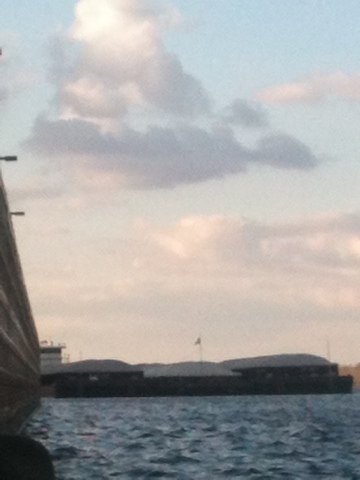
stopping for lunch while a barge passed by. One barge ended up being three, all coming north, then the
southbounders that had been waiting took their turn. We ended up sitting on the sandbar for almost two hours
before the way was clear to continue.
After that, we made decent time, but the day was pretty far along
already. As we came around a bend
to the left, another huge sandbar, we passed a tug with no barges. He gave us a toot with is horn and came
out on deck to wave. The evening
was mild and the wind had finally died down. We made camp on a pretty little hill just at the end of the
sandbar, after a 24 ½ mile day. It
wasn’t as long as we had hoped, but we were back on the right track.
Saturday, November 24, 2012
Day 60: Sn 11/11- New Madrid
After an
early night to bed, we were up before sunrise. Although we could hardly see the river, we could hear the
waves already crashing. As we
packed up and the light grew, we could see that the wind was as strong as it
had been when we stopped the day before, and this was around 6 am. It was a south wind and we knew we only
had to go a mile or so before we rounded the bend and would be heading back
north towards New Madrid, MO.
As
we were eating breakfast, we saw two hunters in blaze orange pop out of the
brush on the mainland. They
probably saw us and we were worried for a bit that they would make their way to
our camp over an exposed sandbar.
We were probably on private property, so we didn’t want to have to
explain our presence. After poking
around the bank for a while, they went back into the woods and we were pushing
off shortly after.
We
managed to get around the bend and head north towards town. We both agreed that if we were headed
into the wind, paddling would have been near impossible. With it at our backs, however, we made
it to New Madrid alright. Our only
real reasons to even try paddling for the day was minimize the risk of getting
in trouble for trespassing at the same site twice and to replenish our beverage
supply in town. New Madrid is on
the north bank of a large bend, after we landed, we knew we would have to fight
our way into the wind back across the river and continue south.
The crossing was one of the hardest stretches we had ever done and there
was a couple of times the boat turned almost broadside to the waves, not
good. We managed to pull her back
around, however, and after a grueling battle, made it to the south shore. We immediately dipped into our newly replenished
goods as a reward, but decided the sandbar we were on was not a good campsite. There was little shelter from the wind,
no wood for a fire and New Madrid was in clear view. We went a little further down, around a dike and made camp
in a more sheltered area; another 16 mile day ended at mile 887.
Day 59: S 11/10- Lazy Day on the Island
We left our
catfish lagoon headed for another windy day. We started out alright, but the wind picked up before
long. It took us hours to make a
few miles headed south into a strong head wind. We stopped for a break on the upriver side of a dike, on a
little spit of sand that was more mud than land. Since it was a sunny, warm day and we were getting nowhere
fast, we decided to call it a day just after noon.
We
paddled through heavy chop to get around the dike and landed just on the other
side on a small, vegetated island.
After setting up camp up in the trees we spent the afternoon looking for
cool rocks, reading Huck Finn and playing with Lilly. We had big plans to wash clothes, take a bath and clean out
the canoe, but the sunshine and relaxation got the better of us and we hit the
sack that night after eating two dinners and doing no chores. We were at mile 903 and had only gone
16 miles.
Day 58: F 11/9- Killer Catfish Hole
We left from
mile 951, our first full day on the ‘Big River’. The fishermen we had met the night before came by after
checking their trot lines and said hi again. They gave us a few more pointers about the buoy system and
told us to steer clear of the channel, again.
mAfter
we had taken off, the going was smooth, for a while. We stayed on the right descending bank for the first few
miles, which actually kept us in the channel, but it was too late to cross. After passing a large barge coming the
other direction uncomfortably close, the wind started to pick up. There was a slight turn to the river
which choked the channel and was churned to chaos with the boat traffic and
wind. We fought through that and
took a shaky break on a beach just after.
When
we pushed off, things calmed down a bit and we gained confidence. Around 940 we came on a long string of
barges moored with tugs attached.
As we rounded the bend we came on a repair yard, which we gathered was
the reason for the line up. After
that we came around Wolf Island Bar, straight into a head wind. The day was warm, but it was taking us
forever to get anywhere. We had
lunch on the island then left for our final windy miles. We made our way around a seemingly
endless sandbar and made camp on its far end, next to a giant, gross killer
catfish hole. With the water down,
it had been cut off from the river and was just a deep dark hole of dirty
water, of course Lilly wanted to play in it. Our camp was at 919, so we had made a surprising 32 miles
for the day.
Day 57: R 11/8- The Big River
We were in for a big day, and one of the last major transitions on the river. The Upper Mississippi River runs to mile 0 at the confluence with the Ohio River. The count then resets at 953 and runs to 0 at the Gulf of Mexico. We had toyed with the idea of stopping at Cairo, IL for supplies, which is the southernmost point of IL, but decided against it because we could only access the town from the Ohio river side. Seeing how the Ohio is actually bigger than the Mississippi at their joining, we had no desire to paddle up it.
We decided to head to Wickliffe, KY instead. It's a tiny town on the outside of a bend just a mile or so from the confluence. As we sat at a sandbar and looked up both rivers, we could see stacks of barges and tugs at the intersection. The town front itself was covered with them and we couldn't even see the ramp that the maps had indicated. But, we chanced it and booked it across as fast as we could. As the two rivers meet they become a swirling mess, conveniently right along the bend at Wickliffe. It was a bit of a struggle getting to the ramp, but we ended up timing it well and sliding in with no trouble.
We walked about 2 miles to PeeDee's food mart, but it ended up being little more than a gas station. Luckily there was a dollar general across the street that had what we needed. We even got a couple of Snickers ice cream bar as a treat.
By the time we got back to the boat we were running out of daylight. We grabbed the phones from where they had been charging, thankful they had not been stolen, and refilled our water. As we pushed off three guy were putting in their fishing boat. We were already caught by the current, so we couldn't really chat, but we said hi and they asked where we headed and shouted a good luck.
We only went across the river and about a mile down before stopping for the night. The fishermen came by as we were setting up to say hi and see what we were up to. They were out checking their trot lines and were real nice. They gave us some tips about the channel asked a few questions and were off before dark. We only made about 20 for the day, but we had finally made it to 'the big river'!
Sunday, November 18, 2012
Day 56: W 11/7- Commerce
It was a fairly heavy wind from the south but we still made good time for the 9 miles to Commerce, MO. We stopped here at a little boat launch and walked up to a town that was almost dead. There was maybe one house on each block that was inhabited. A few dogs followed us through part of town. We were able to get our package even having left our ids in the canoe.
We dealt with a lot of barge traffic when we left and had to stop again to let it clear. We still made 30 miles for the day and made camp at a cut little wing dam lagoon.
We dealt with a lot of barge traffic when we left and had to stop again to let it clear. We still made 30 miles for the day and made camp at a cut little wing dam lagoon.
Day 55: T 11/6- The day Aaron lost his hat :(
Woke up a bit groggy and had a slow start on Tuesday morning. We left our little island, at mile 78, for another gray and cool day. We stopped for lunch north of Cape Girardeau, MO and had some questionable hotdogs.
As we passed the town, about miles 50-55, they began to make their presence known. To keep our minds off of upset tummies and cold winds we started making up a story about a spunky dog named Milo and his parakeet friend, Ruffles. We made up adventures for them, taking turns making the story up until we were just past town.
Sadly, at this point Aaron realized his hat was no longer on his head and no where to be found in the boat. He was pretty bummed to lose his favorite felt hat, but stayed hopeful that it might drift down and be reunited with us at some point.
We stopped at mile 49 on Marquette Island and camped on the beach right by the canoe. There was plenty of driftwood to burn and a clear view of the river to sit and watch for Hat. No luck though, as of yet. :(
Day 54: M 11/5- Tower Rock
The day was rainy, but the wind wasn't bad and it was warm enough. We paddled through it uneventfully.
We slowed down to admire a tall, rock island as we came to the city of Grand Tower. I assume the town was named after the island we saw, Tower Rock from the Louis and Clark exploration.
We stopped at an RV park and got water. We stopped in town too, looking for power. A little town with out power at their ramp, but we did find out that their was a little party store less than a half mile away. We decided to see if they had anything we could use. They didn't have much; but in order to not leave empty handed, I bought some chess puffs.
We left town and went a half miles to the other side of the river and stopped for the day. We had already made 26 miles and it had started raining again. We sat in the rain on the beach and ate cheese puffs for the afternoon. It was quite pleasant. When the rain broke a little before dark we set up camp.
Day 53: Sn 11/4- Kaskaskia river
We left from mile 137, about ten miles north of Ste. Genevieve, MO. There was a whole lot of nothing until we passed the town. Then there was a bunch more nothing after the town. We did pass the Kaskaskia river, which comes in at 118. As we went by we looked upriver and could see a lock and dam. Besides dodging the standard
barge traffic, the day was uneventful and we stopped at 104 for the night, 33 for the day.
barge traffic, the day was uneventful and we stopped at 104 for the night, 33 for the day.
Day 52: S 11/3- ThunderDrum Crew
We started toward a little, private owned dock/gas station called "Hoppies". It was only about six miles down and the current was fast so we made it in about an hour. As we approached the dock, we noticed a few guys near a sailboat. We had assumed they were the people who ran the place, so we asked if we could land and they said sure. It turned out they were traveling down to the gulf as well. Pete owned the boat and was planning on making his sailboat "ThunderDrum" a lifestyle. He had a couple of friends with him, Chris and Matt. Chris I think was going as far as Cairo. Pete had one other friend who was in it for the long hall, his cute little dog Butters.
They were incredible hospitable and showed us their boat. We stayed and. chatted for over an hour. As the winds picked up from the North, they decided to part. Lily and Butters were off exploring together, but didn't go far. We said farewell and good luck and they were off. It would be nice to run into them again down river.
After they left, we moved our canoe to the inside of the dock, to avoid barge waves. And went up to find the owner to ask if we could leave the canoe there while we went into town. We found three guys putting a trailer on and they said it was fine.
Our walk would be about two miles each way, down a country road, through the little tourist town of Kimmswick, and a few roads further to a less cute commercial area. Kimmswick is apparently famous for their apple butter and was full of people from sidewalks into the streets.
We got our supplies and back to the boat to find water in it. Apparently their was a drain pipe in the dock their. It's difficult to describe how the dock was put together. Regardless, we bailed out the canoe, moved it, got water, ate lunch and left.
Even with our long resupply and encounter with new friends, we made 27 miles for the day and camped in between wing dams.
Day 51: F 11/2- St Louis
We headed to St. Louis excited but a little nervous. After two short miles we came to the Missouri rivet and the start of the Chain of Rocks Canal. The canal is a ten-ish mile man made structure to avoid the Chain of Rocks. This is a natural geological escarpment as well as the remnants of an old low overhead dam. With the water so low we knew we couldn't navigate the rapids by the Chain, so decided to go down the canal and through lock and dam 27.
As we entered the canal, the MO river pushed us in and created some turbulent water. As soon as we entered the current nearly stopped and the waters calmed. We then saw a barge stretched across the canal an not moving. We waited, a bit nervously, a he repositioned and found a spot on te east bank. We finally snuck around him, thankful he didn't suddenly move again, and spent the rest of the canal dodging moored barges. We finally made it to the final lock, without being squished, and approached the doors. We got the green light and entered the huge lock chamber with no worker in sight. We never did see anyone, but eventually the lock drained and we were through the last lock of the river. Paddle high-five!
After we left the lock, the canal rejoined the main river and things really got going. We could tell immediately that the current was faster; we went cruising under bridges and past buildings and paddle through strong eddies. The next couple of miles took us past downtown St. Louis and the famous arch. We toyed with the idea of stopping for a visit, but contented ourselves with some pics and paddled on.
After the picturesque tourist sector we reentered barge country. There were miles of moored barges along either side of the narrow channel and numerous tugs zigging and zagging every which way. The wakes intersected and bounced off of the shore and barges and made a lovely chop soup. I was very nervous until we finally left this industrial area and found the open river once again.
We hadn't seen a mile marker since the last lock and were excited to see how far we had gone and if we could stop soon. When we finally spotted a marker we took guesses about our distance and Aaron won with an optimistic (read: silly) guess of 35. We were pleasantly surprised to see we had actually made it to mile 165, 33 miles for the day. We called it good then and there and made camp across from an industrial plant that ended up making sounds like a mechanical cow all night. But, we were very excited to see how quick the current was running after the last lock. It was a big day for us and we were excited to start the next, lockless, leg of our trip.
Day 50: R 11/1- Al the Artist Fisherman
We cruised early off, knowing that it was going to be a short day. We stopped at a marina and were able to refill our water. We tried stopping at a park to charge the phone but failed to find any. We also passed a statue turned out toward the river, which was the "Lady of the Rivers".
The Mel Price Lock and Dam (26) was pleasant and informative as the friendly lock operators gave us pointers on the confluence of he Missouri River into the chain of rocks channel.
After the lock we pulled up immediately off to the shore were there were a few fisherman. When we landed, a guy who was setting up came down the hill and chatted with us about our trip an shared about his life. After our interaction we went up to the pavilion of the park and finally found power. We charged the phone and Maggie walked over to the museum at the park to find out more about the "water trail". She found out that the campsites below lock 27 existed but weren't mapped yet. As we were less than fifteen miles to lock 27, we didn't buy the map nor gather any information. When we were about to leave the pavilion after charging our phone, our fisherman pal came for another chat as he was finishing up.
His name was Al; and he was, self proclaimed the worst fisherman. He also an early retired artist and dealer, kind hearted fellow, eager to help us how ever he could. He offered to run us to a store, but we didn't need anything very badly and needed to go before dark, we refused. He even offered to give us his number to help us closer to St. Lois where he lived. We chatted a bit and he told us a bit about the "Lady of the Rivers", then he sent us off with a couple of delicious beverages he had left over from fishing.
The whole day with the wonderful interactions, beautiful weather, and ability to charge up and get water, boosted our sprits. We made a few miles through the industry and pulled off on the last federal island before the chin of rocks, which was on the chain of Maple Island. About seventeen miles for the day but we would be ready for St. Lois in the morning.
Day 49: W 10/31- Break from L/D 25
As we made camp the evening before, one of the workers flagged us down and informed us that the lock would be closing again on Wednesday morning at 7 am. We had decided to camp by the locks, so he told us to wake up early and call the lock so they could sneak through before they closed again.
So, I braved the early morning and woke up at 4 am and called the locks. The guy working was really friendly and informed me that plan had changed and the lock would remain open through the morning. Since it was still hours til dawn we went back to sleep and reset the alarm for 6:30. I then called them again and another worker told us we would be clear to go in one hour. We hopped up and broke camp as quick as possible to be there on time.
Unfortunately, as we were paddling up to the first barge in line we saw that he was already getting into position. I called again, right at 7:30, and the guy told us that we were too late and since no one had seen us they gave the barge the go-ahead. And so, our 20 minute locking was delayed almost 3 hours because of an impatient lock operator. Such is life, but Aaron got to hear exactly what I thought of the situation while we waited...
Eventually it was our turn and we made it in the lock. A very nice lock operator bought us a couple of sodas and chatted about the super Sandy storm out east. The kind gesture and talk put us in a better mood and we took off looking to make up some miles.
Aaron was still feeling pretty low, but stayed strong and we made it past the confluence with the Illinois river. We aimed for Slim island and camped around mile 216. The island was long and narrow and had steep foot high banks all down it. We finally found a place to haul the boat up and waded through the debris and trash to a pretty cozy campsite.
Day 48: T 10/30- Closed Lock and the Snack Stranger
It was fairly windy in our favor as we started out in the morning. We were already making food time but I thought that we should take more advantage of the wind. Upswing the oars as a double mast and whatever strings and bunge cords we had accessible, I fastened a slap together tarp sail. It only worked when the wind was directly behind us, and unfortunately the river took a change of direction in a couple of hours. We were happy to find that we were making our fastest time yet at a lightning fast five miles per hour. (With paddling)
Our excellent pace proved to be in vain. With twenty miles down, we approached lock 25, and noticed three tugs waiting on the side of the river. We continued on and saw two more tugs waiting outside the dam. We found a corner in the shores rock wall were sediment had built up forming a marshy area. Rather than passing the front barge we landed roughly there with four foot waves pushing us while we worked around the dozens of logs that had been pushed up there. We walked down to the lock and notices that there was a lot of people and activity. When we got to the fence that had an open gate, we were just about to enter when a security lady came out of the security post. She was kind and helpful. She told us that the lock was closed until 7:00pm that night. They were doing maintenance. We chatted with her and a couple other officials that came out to us. Through these chats we eventually got word from the lockmater that we could camp in the little day park that they had next to the dam.
We returned to the canoe, secured it better and carried our stuff the quarter mile back to the park. At this point I was starting to get hit with a second wave of being sick.
We had a very kind and strange encounter to go still before bed. While we were up reading a billboard about the "water trail", a guy showed up to walk his dog down the dams break-wall. We waved as he got out and Lilly showed her enthusiasm for his dog. He walked and we returned to our unsetup campsite. When he went back to his truck, he put his dog away and then started walking towards us with a box. We greeted each other when he was close and he set the box down and told us it was a box of snacks and asked if we wanted one. Unknowing that he meant the whole box, we accepted and took one. When we thanked him he told us that we could have the whole thing. We tried to refuse, but he was insistent. We talked a little, but it wasn't until the last couple comment followed by his quick departure that we realized that he probably thought that we were truly homeless. We couldn't do anything about it, as he was already gone, but we felt bad anyway. We did eventually decide that we should enjoy the generosity. It is great to know that there are some really good people out in this world that are willing to extend kindness to a stranger. We never even got his name as our encounter was brief, but thank you for the kind snack stranger.
Day 47: M 10/29- Great River Water Trail
We took off from Gilbert Island, mile 296, pretty early. We passed by Louisiana, MO, mile 283, in the afternoon, which got us thinking of our destination state and how far we still had to go.
We made good time to L/D 24 at mile 273, no barge sandwiches at this one. The guys working were friendly and informed us there was a grocer right after the lock if we needed supplies. We were good on groceries, but we did stop at the Clarksville, MO park to refill our water.
As we were bringing our water jugs up to the restrooms we saw a 'Water Trail' sign with a canoe symbol. We weren't sure what it was for, but later looked it up. Apparently MO and IL maintain a 200 mile water trail from mid-MO to Cairo, IL, with campsites and all.
We ended up paddling for a chunk of federal land another 10 miles down river. We made our longest day yet and camped on a small island 34 1/2 miles from the day's start.
Wednesday, November 14, 2012
Day 46: Sn 10/28- A Mark Twain Barge Sandwich
We got a good start in the morning with some nice sunny weather. We made the 11 miles to Hannibal quickly. We were excited to see Mark Twains hometown, since we were re-reading a copy of Huck Finn that my mom gave us.
The downtown/riverside of Hannibal was super cute with some brick roads and everything seemed to be name the "Mark Twain ______". The income level appeared to drop suddenly as we got toward the top of the hill and came up on the combination Family Dollar/Save A Lot. We were able to resupply a lot of our supplies including dog food. We carried our supplies the mile back to the river and ate lunch on the dock.
While we ate and admired the Mark Twain Paddle Boat(pic), a big barge passed us which was unfortunate because Dam #22 was eight miles down. We followed the barge a few miles back and gained sight of the dam while he was still finishing positioning to start locking. We drifted up the last mile or so and finally hung on to a mooring piling. When we eventually decided to go and wait on shore we saw another barge coming up. We didn't want to wait another two hours so we stayed close and hurried up to pull the signal cord as soon as the tug entered the lock.
The lock guy came out to us on the guide wall and instructed us to pull up the just outside the gates and hang onto a service ladder. They were going to get us through between barges but the barge behind us was lining up on the guide wall right behind us. That was a little freaky being between a hydraulic gate and a huge barge.
We made it through the lock without getting squished. Behind schedule, we paddled until after the sun disappeared and made our camp on Gilbert Island. Making and eventful day with 24 miles accomplished.
Day 45: S 10/27- Grocery hunt
We left mile 350 and weaves our way through a series of islands in the pool leading up to lock and dam 20. We passed by Canton, IA and La Grange, IA in the morning, hoping to find a grocery store to resupply. We thought one building in La Grange looked promising, but it turned out to be the Mark Twain Casino. That left us Quincy, IL to try for the day.
The wind was still in our favor, but the high was 50 and our sunny morning clouded over as we reached Quincy. Aaron walked up to a "grocery store" that ended up being a bust while Lilly and I paced around a park to stay warm. All we got was some cereal, some apple butter and little Debbie snack cakes, but it was better than nothing. Lock an dam 21 was around the corner from town and we made it through no problem. The guys working were both really nice and chatted about our trip. One said he was pretty sure we were crazy but admired our tenacity :)
We ended up at mile 320 for the day and camped on Goose Island.
Day 44: F 10/26- Welcome to MO
The next morning was still quite windy coming from across the river. The river made a turn back to the south which put the winds mostly at our backs.
When we approached dam #19 at Keokuk, IA the workers were doing some sort of maintenance on a barge deck. They started filling for us but we had to hold steady for close to a half hour. All the wind was funneling into the corner between a plant of some sort in the water and the dam. The waves were huge and turbulent. We ended up taking on a bunch of water from them breaking over the gunnel, but we bailed it out while we "locked down" 38 feet.
The rest of the day was calmer under the dam. We made it to the MO border and then some. Making 31 miles before setting up camp on Buzzard Island.
Day 43: R 10/25- Blown away
We woke up with the winds already coming strong out of the south. The river runs east to west at this point so we had to head straight across the channel first thing to get to the leeward side. After that half hour, tedious exercise we headed downriver.
The day started warm and sunny, but the weather was calling for a temperature drop to 50 and thunderstorms for the afternoon. We got stuck going across a deep bay straight into the winds. We finally battled to shore to take a breather, but it was a pretty good fight. After that we stayed as close to shore as possible. As the clouds rolled in and the rain started the wind seemed to get even worse. We were eventually pushed onto the Illinois shore several times and decided to call it. We camped on the side of a huge hill on a little flat spot just big enough for the tent. We were across from Fort Madison, IA at mile 381.
The day started warm and sunny, but the weather was calling for a temperature drop to 50 and thunderstorms for the afternoon. We got stuck going across a deep bay straight into the winds. We finally battled to shore to take a breather, but it was a pretty good fight. After that we stayed as close to shore as possible. As the clouds rolled in and the rain started the wind seemed to get even worse. We were eventually pushed onto the Illinois shore several times and decided to call it. We camped on the side of a huge hill on a little flat spot just big enough for the tent. We were across from Fort Madison, IA at mile 381.
Thursday, November 1, 2012
Day 42: W 10/24- Daddy Long Legs oh My!!
We made it through lock 18 early in the morning without any problems. The wind was up today but we fought through the headwinds and were able to stay mostly on the leeward side on the river. We decided to take the grape chute which runs parallel to the main channel but was wonderfully sheltered from the wind. The side of the chute had a cute campsites that ran a hundred yards apart and each had their own dock. We chatted with a few of the campers as well as a couple of older fishermen that were cruising the chute. We saw the fishermen at the top of the chute twice in the middle and again at the end. They warned us that when we turned the corner out of the chute the waves and eddies were huge. They even offered to have us throw our canoe up on their boat and they would drive us to wherever we needed to go. It's nice to know that their are kind people out there willing to help if needed.
When we did round the corner we were certainly meet with ruff water. Slowly but surly we plowed through it and made our way down the windy side of the river to our camp for the night on Lead Island.
A hard day but we made our 24 miles. Also the should rename Lead Island, Daddy Long Leg Island as there was about 10 for every square foot. I have no clue what they eat because they were significantly the most infected creature on the island.
Subscribe to:
Posts (Atom)